What Type Of Climate Does Afghanistan Have?
Afghanistan is situated in the middle of south-central Asia. It lies along vital trade routes that connect eastern and southern Asia to the Middle East and Europe. Kabul is the nation’s capital and the largest city. The country is entirely landlocked, and the nearest water body is the Arabian Sea which is some 300 miles away.
The nation’s isolation, as well as its volatile political history, means that it is among the most inadequately surveyed countries in the world. The nation is bordered to the north by Uzbekistan, Tajikistan, and Uzbekistan, to the west by Iran, and to the south and east by Pakistan (with parts of Kashmir which is claimed by India but governed by Pakistan). China also borders the country to the northeast.
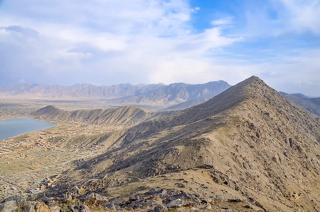
Among the most important features in the country is the Hindu Kush, a mountain range that helps create three distinct geographical regions namely the southwestern plateau, the central highlands, and the northern plains. About 100 miles to the north of Kabul the mountain range spread out and continues westward as many ranges such as the Sefid Kuh, Baba, Bayan, and others. Other important ranges include the Hesar Mountains, Siah Kuh and, and Khakbad. Close to the border with Pakistan, some mountain ranges isolate the country interior from the winds carrying moisture from the Indian Ocean thereby contributing to the dry climate.
Climate
Afghanistan sees hot summers and extremely cold winters which are typical in a semiarid steppe climate; however, there are many regional variations. The mountain regions in the northeastern part of the country experience a subarctic climate that has dry and cold winters. The mountain region close to the border with Pakistan is affected by the Indian Monsoon which usually comes in July and ends in September bringing rain and maritime tropical air masses carrying humidity.
During summer, intense winds frequently blow in the southwest. The elevation influences a further variation on conditions. The climatic conditions and weather in early spring are significantly influenced by cold air masses which come from the north and the northwest. Both air masses lead to severe cold and snowfall in the highland areas.
Temperatures
The temperatures in the country vary widely. In the Southwestern Plateau, daytime temperatures can reach highs of over 95 degrees Fahrenheit. In areas such as the Jalalabad which is among the hottest areas in the country, temperatures in July can go as high as 120 degrees Fahrenheit. In January, high mountain areas may experience a drop in temperatures to 5 degrees Fahrenheit or below. Kabul, which is at an elevation of 5,900 feet above sea level, experiences temperatures as low as -24 degrees Fahrenheit.
Precipitation
The annual mean precipitation in mountainous regions increases from east to west. The average precipitation in areas which receive the southeastern monsoon area is about 16 inches. Areas that have recorded precipitation extremes include the Salang Pass of the Hindu Kush which experienced 53 inches of annual precipitation. Arid regions such as Farah to the west receive an average of 3 inches of precipitation per year. The months of December to April experience the most precipitation. In the Highlands, the months of December to March have snowfall while intermittent rain is experienced in lowlands in the months between December and May. Summers are dry and hot in the majority of places apart from the monsoon region.
Kabul
Kabul is the country’ largest and the capital city. The winter in Kabul is cold with average January temperatures of 30 degrees Fahrenheit and freezing nights. Snowfall is quite frequent and can at times be heavy. The summers in the city are hot and at times scorching during the day and cool during the nights. Precipitation is relatively low with an average of 12 inches in a year. Spring is the rainiest season while summers rarely rain. The months of January to April receive the highest rainfall.
Kandahar
Kandahar is the second largest city in the country and is situated in the southeast close to the desert at 3,300 feet above sea level.The daily average temperatures are 45.5 degrees Fahrenheit in January and 88.5 degrees Fahrenheit in July. The winter is mild but the nights are cold with possible frost. During summer it is usually sunny and scorching hot. The rainfall in the area is inadequate since it does not reach 8 inches per year.
Herat
Herat is the third largest city in the country situated to the western part of the country and it is located in an elevation of about 2,950 feet above sea level in the Hari River Vally. The temperatures during winter are cold but just above freezing point. Snow and intense frosts are sometimes experienced. The summers are sunny and hot and are characterized by intense winds that blow from the north. The precipitation is low at 9.5 inches per year.
The Best Time to Visit Afghanistan
Those who want to visit the country are advised to do it during spring and autumn to avoid the cold winter and the summer heat. The months of April and October or March and November in the southern deserts are recommended. Those months can, however, experience hot days and cold nights. The autumn season is also drier and less windy, making it the ideal time to visit. Mountainous Regions above 6,500 feet can be visited during summer because the rest of the year is typically cold. The Mountainous regions to the far eastern part of the country experience summers which are affected by offshoots of the Monsoon winds.


