Manaus – the Capital of Amazonas, Brazil
Amazonas is a Brazilian state that is situated in the North region of the country. Amazonas is the world’s ninth-biggest nation subdivision and the largest in Brazil. Amazonas is bigger than Chile, Paraguay, and Uruguay combined. The state occupies an area of about 606,468 square miles and has a population of over 4,080,611 people. Amazonas is surrounded by Acre, Rondonia, Mato Grosso, Para, and Roraima. The state also borders Venezuela, Colombia, and Peru.
What Is The Capital Of Amazonas?
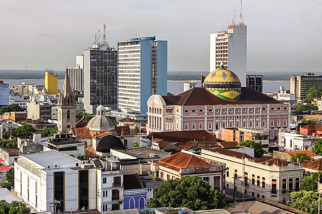
The capital city of Amazonas is Manaus. With over 2 million residents, Manaus is the most populated city in the Amazon rainforest. The city is situated at the center of the Amazon and can only be accessed by airplane or boat. The isolation of the city helped preserve its culture and natural environment. Manaus serves as the access point to visiting the Brazilian Amazon’s flora and fauna. The city is on the northern bank of River Negro near the confluence of Solimoes and Negro rivers. It is the hub of tourism for river cruises, jungle lodges, and rivers. The city is a duty-free zone.
History Of Manaus
The city was established in 1669 when the Portuguese constructed a fort known as São-José-do-Rio-Negro. The indigenous mestizos, who had assisted the Portuguese in building the fort, started living in the vicinity. The region’s population increased at a very high rate that the Missionaries constructed a chapel in 1695. The area was converted into a town known as Manaus in 1832. Manaus town became a city known as Barra-do-Rio-Negro in 1848 under Law 195 of Para’s provincial assembly. Governor Pena Ferreira gave the city its previous name ‘’Manaus’’ on September 4, 1856. Rubber made Manaus the wealthiest South American city during the late 1800s.
Geography Of Manaus
Manaus is the biggest northern Brazilian city which occupies an area of about 4,402sq miles and has a population density of about 450individuals per square mile. The city is surrounded by Novo Airao, Itacoatiara, Rio Preto-da-Eva, Iranduba, Careiro, and Presidente Figueiredo. Even though it’s situated in the Amazon, Manaus has very few green regions. Some of the biggest green areas in Manaus include Mindu Park, Bilhares Park, and Samauma State park among others.
Climate
The city receives a humid tropical rainforest climate with a rain index of about 90.6inches, relatively high humidity, and an average temperature of 27.6°C per year. Summers are stormy in Manaus while winters are quite dry. The city does not experience cold days during winter because of its proximity to the equator. The strong polar air masses in the southwestern parts of the Amazon and the south-central parts of the country affect the city.
Demography
The city had a population of over 2,145,444 resident in 2018 with 2,631,239 people living in Greater Manaus. The Greater Manaus is the made up of thirteen municipalities including the capital city of Amazonas. Over 47.93% of the residents were men while 52.07% were women. Manaus’s population grew from 343,038 people in 1960 to 1,025,979 residents in 1990. The population growth rate of Manaus is 10% bigger than the average growth of Brasilia. A huge percentage of the locals live in the eastern and northern regions of Manaus.


