What Is The Capital City Of Mongolia?
Mongolia is a landlocked nation in East Asia, sandwiched between Russia to the north and China to the south. With an area of 603,909 square miles and a population of approximately 3 million, Mongolia has one of the world's lowest population densities. It is the second largest landlocked state, after Kazakhstan.
The Capital of Mongolia
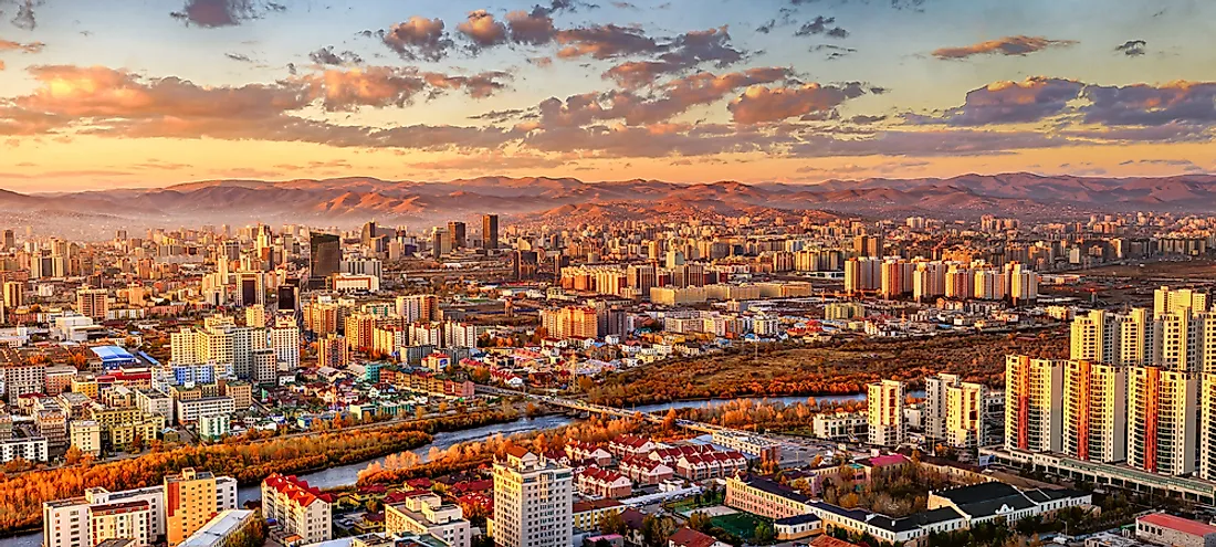
Ulaanbaatar is the capital and largest city in Mongolia. Categorized as a provincial municipality, the city is not part of any Mongolian province (aimag) and has a population of more than 1.3 million, which is nearly half of the national population. Ulaanbaatar is located in the north-central part of Mongolia and sits at an altitude of about 4,300 ft within the valley of the Tuul River. The city is Mongolia’s financial, industrial, and cultural center, and is linked to both the Chinese rail system and the Trans-Siberian Railway.
Name and Etymology
The city has had various names throughout its history. Known as Ikh Khuree prior to 1911, the city was renamed Niislel Khuree after Mongolia gained independence in 1911. When the Mongolian People's Republic was formed in 1924, the city was renamed again as Ulaanbaatar and named the capital.
History of Ulaanbaatar
Founded as a nomadic Buddhist monastic in 1639, Ulaanbaatar was initially situated at Lake Shireet Tsagaan nuur, approximately 143 miles southwest of its current site and 47 miles east of Karakorum. Initially named Orgoo, Mongol nobles intended the town to be the seat of Ondor Gegeen Zanabazar. Zanzibar returned from Tibet in 1651 and established seven monastic departments (aimags) in Mongolia, and eventually another four. As a nomadic monastic, the town moved from one place to another along the Tuul, Orkhon, and Selenge rivers. Ulaanbaatar moved from Khui Mandal to its current location, near the confluence of Tuul and Selbe rivers, in 1778.
Administration and Subdivisions
The city is divided into nine municipal districts, called düüregs: Sukhbaatar, Songino Khairkhan, Khan Uul, Bayanzurkh, Bayangol, and Bagakhangai among others. These districts are then subdivided into 121 subdistricts, called khoroos. Ulaanbaatar is governed by a city council which is made up of 40 members. The mayor is typically appointed by the city council.
Ulaanbaatar has a central district which was constructed using 1940s and 1950s Soviet-style architecture, surrounded by various concrete tower blocks. The ground floors of most of these tower blocks have been modified into small shops in recent years. Numerous new buildings have been built all over the city.
Economy
As Mongolia’s industrial center, the city produces numerous consumer commodities and is responsible for two-thirds of the country’s gross domestic product (GDP). The shift to the service industry in 1990 contributes about 43% of Ulaanbaatar’s GDP, while the mining industry contributes about 25%. Northern parts of the city have numerous gold mines, including the Boroo Gold Mine.
Tourist Attractions
The Gandantegchinlen Monastery is one of Ulaanbaatar's main sights and features a large Janraisig statue. Other popular tourist attractions include Chinggis Square, Winter Palace of the Bogd Khan, and the Zaisan Memorial. Ulaanbaatar has several museums, the most notable being the Zanabazar Fine Arts Museum and the National Museum of Mongolia. Other attractions near the city include the Genghis Khan Equestrian Statue, the Manzushir monastery, and Gorkhi-Terelj National Park.


