The Most Extreme Points of Sweden

Sweden is a nation in the Scandinavia Peninsula of the European continent. The nation is bordered by Norway, Finland, the Baltic Sea, and the Gulf of Bothnia. In Sweden, the extreme points include those that are furthest in terms of the four cardinal points, that is, east, west, south, and north, as well as the highest and lowest points in terms of elevation. All the extreme points of Sweden are not ambiguous owing to the fact that the nation, unlike Norway and Denmark, does not have any external territories that might bring about confusion. Additionally, there are extreme points in terms of transportation, that is, the most extreme airports, railways stations, and bus stops. These extreme points of transportation are also determined according to the four cardinal points of a compass as well as elevation.
6. Northernmost Point in Sweden
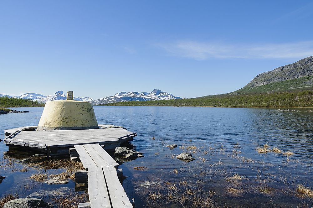
The northernmost point in Sweden is located in a place known as Treriksröset in the Swedish province of Lapland in the area denoted by the coordinates 69.06° N 20.548611° E. Treriksröset, which translates to Three-Country Cairn in English is the area where the borders of three nations namely Sweden, Finland, and Norway meet. The name Three-Country Cairn is also the name of the tripoint monument that is located at the place.
The monument, which was built using stones, was erected by the governments of Norway and Russia in 1897 when Russia was still governing Finland. The Swedish government had boundary problems with the government of Norway and was not part of the monument’s erection until 1901. Aside from being the northernmost point of Sweden, Treriksröset represents the westernmost point of mainland Finland. The tripoint that is currently erected there goes as far back as 1926 and is about 1,604 feet above sea level. The conical structure has a diameter of 13 feet and an area of about 150 square feet.
5. Southernmost Point in Sweden
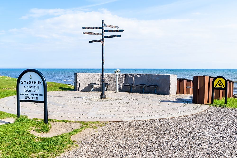
Sweden’s southernmost point is located in the fishing village of Smygehuk located in Smygehamn in Sweden’s province of Skåne or, as it called in English, Scania. The southernmost point of Sweden is marked by the area within the coordinates 55.336944° N 13.359444° E. Aside from being Sweden’s southernmost spot, this village is also the southernmost point of the entire Scandinavian Peninsula.
In the harbor, there is a statue of a nude woman that was designed and installed in 1930 by an artist known as Axel Ebbe. The statue is known as Famntaget, which translates to “the embrace.” The model of the statue is based on Birgit Holmquist, the grandmother of actress Uma Thurman and mother of Nena von Schlebrügge.
The nearby Trelleborg, some 6 to 9 mile away, is the southernmost town of Sweden. Aside from being a crucial ferry town around the Baltic Sea, this area is also critical to the entirety of Scandinavia. The embrace is clearly visible from Trelleborg. Today, the region is frequented by visitors who are on their way to Germany from Sweden because of the ferries which go to Germany.
4. Westernmost Point in Sweden
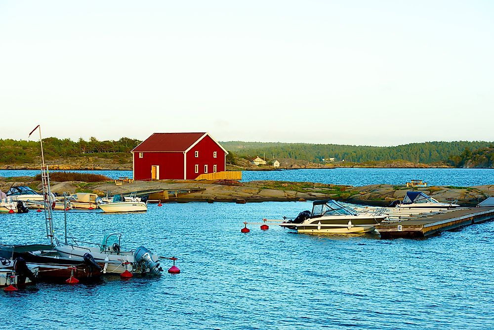
When looking at the westernmost point of Sweden, two points emerge depending on the definition of Sweden. The westernmost point of Sweden is located in an area known as Stora Drammen, Strömstad, in the province of Bohuslän. The exact location of the point can be traced using the coordinates 58°56′ N 10°58′ E. Stora Drammen is a small island, or an islet, located in the northwestern side of Kosteröarna. While looking at the westernmost point of mainland Sweden, then the point changes to a place known as Stensvik, also in the same region of Strömstad. This point is marked by the coordinates 58.997222° N 11.113056° E.
Strömstad is a small city within the Strömstad Municipality of Sweden’s Västra Götaland County. Located close to Norway, the small city is surprisingly busy throughout the year because of the ferry services linking it Sandefjord, Norway, especially in the months between June and July and the Easter period. Among all the towns located to the north of the Alps, Strömstad is said to receive the most sunshine during the summer.
3. Easternmost Point in Sweden
The easternmost point of Sweden is located in Kataja, which is an islet lying to the south of Haparanda within the province of Norrbotten. The small island lies on the border between Sweden and Finland so it is divided between the two countries. The easternmost point lies on the coordinates 65.710833° N 24.155833° E. The islet is about 180 acres, has a length of 1.2 miles, and has a width of between 660 feet and 1,640 feet. The larger Haparanda locality is next to Tornio, Finland.
Initially, back in 1809, the border between Sweden and Finland was between two islands with either country having one island. The island on the Swedish side was bigger and was known as Kataja while the smaller Finnish one was known as Inakari. However, over the years, geological processes have raised the land in the region thus leading to a joinery of the two islands as they are known today.
2. Highest Point in Sweden
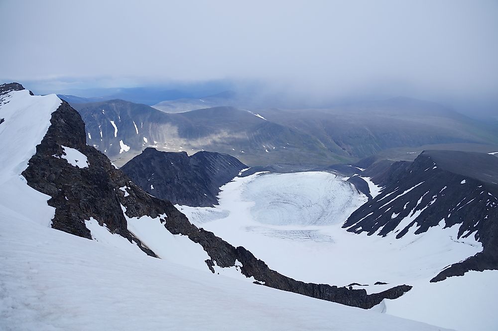
The highest point in the nation is Mount Kebnekaise with an elevation of about 6,883 feet at the coordinates marked by 67.9° N 18.516667° E. The mountain, which is part of the Scandinavian Mountains chain, has two major peaks; the southern and the northern peaks. The northern peak is 6,883 feet above the sea level as of August 2014 while the northern one is 6,979 feet above the sea level and free of ice. Experts predict that the northern peak will soon be the highest because of dwindling glaciers of the southern peak. Mount Kebnekaise is in an area called Sapmi, which is close to the Arctic Circle and Kiruna.
1. Lowest Point in Sweden
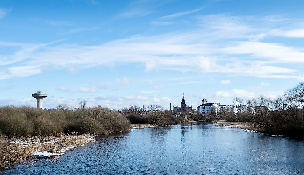
The lowest point of Sweden, which is 7.91 feet below sea level, is in the Kristianstads Vattenrike Biosphere Reserve in Kristianstad. The coordinates for this point are 56.021581° N 14.178878° E in what was once a bay known as Nosabyviken on Lake Hammarsjön. In order to obtain more land for agriculture in Kristianstad, the bay was drained by an engineer known as John Nun Milner in the 1860s.
Currently, the reserve is responsible for providing a safe habitat for a number of endangered species of fish and birds. Aside from that, there are other sights in the place such as things from the Ice Age. All of these factors contribute to the mammoth number of people (around 100,000) visiting the place every year.


