The Most Extreme Points of Norway
The kingdom of Norway is a Scandinavian country located in the continent of Europe. It occupies a total area of 148,747 square kilometers that encompass mountains, deep coastal fjords, and glaciers. According to 2013 Census report, Norway had a population of approximately 5 million people. The country borders Sweden to the east on a border length of 1,006 miles. Finland and Russia are on the northeast while the Skagerrak Strait is to the south and Denmark located on the northern side. Norway has a long coastline that faces North Atlantic Ocean and also the Barents Sea. There are extreme points in all directions that include coordinates furthest either east, west, north, or south and the lowest and highest attitudes in Norway. The country’s most extreme points are discussed below.
6. Northernmost Point in Norway
The extremely northernmost point in Norway is known as Rossøya and which translates to the Ross Island in English. Ross Island is on Svalbard in the Arctic Ocean. The point is part of a group of islands known as the Sjuøyane on the Svalbard Archipelago in the Finn Mark administrative area. The closest Island to Rossøya is Vesle Tavleøya located about 100 meters north-northwest. A British explorer called James Clark Ross (1800-1862) named the Island during the exploration journey of 1827. Rossøya Island located on 80° 49′ 44.41″ north and is only 1024.3 kilometers to the North Pole. Accessing the island using a ship is difficult due to the freezing conditions in winter while during summer the ship can easily sail there. The island has green patches due to the effects of a plant known as Cochlearia groenlandica which thrives on birds excretes. Few species of birds migrate to the region during summer. These birds include Atlantic puffin, little auk, and the Brunnich guillemot. Polar bears are also common on Rossøya especially in winter due to the presence of ice.
5. Southernmost Point in Norway
The location considered as the southernmost point in Norway is Pysen in Manda. Pysen is located in a tiny skerry in the municipality of Mandal in Vest-Agder County at Pysen are 57.9585°N 07.5645°E coordinates. The small rocky island is too small for people to settle. It measures only 250 square meter or 0.062 acres and is also the southernmost place of Norway proper. It is located in the traditional district that was known as Sørlandet. Manda region is among the least populated regions in Norway with a population density of 74.1 people per square kilometer. Mandalselva River passes through the region with its mouth near Pysen.
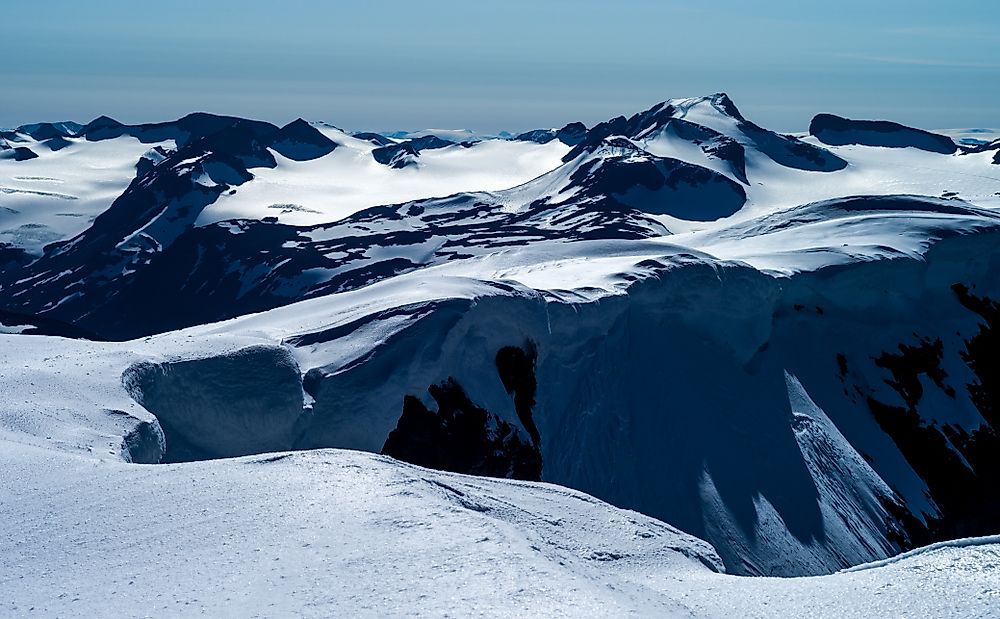
4. Westernmost Point in Norway
The Westernmost point in Norway is Hoybergodden on Jan Mayen. The point is administered by the governor of Nordland County. The administration country code is “SJ” and is on ISO 3166-1 alpha-2. The Island was first discovered and named in 1614 by explorers who reached the point under Dutch Captain Jan Jacobszoon May. The point on the volcanic island of Jan Mayen is rarely inhabited except for a few personnel working for the Armed forces and the meteorological institute. Government employees posted to work on the island live there for about six months before being replaced with others since the living conditions there are unfavorable. Hoybergodden is in the Arctic Ocean. Jan Mayen is 34 miles long and occupies a total area of 144 square miles. Glaciers cover almost the entire region, especially during winter. Jan Mayen is generally mountainous and has numerous large lakes that freeze during winter.
3. Easternmost Point in Norway
The easternmost point in Norway is known as Kræmerpynten on Svalbard. The name of the location was derived from Waldemar Hilbert Kræmer, a captain and an animal trapper in Spitsbergen. The point is at 33° 30' 59'' E coordinates and is also the easternmost point of Kvitøya (white island), Svalbard. Kvitøya is an island in the east of Norway in the Svalbard Archipelago. It covers a total of 263 square miles in the Arctic Ocean. The larger part of the Island is covered by an ice cap except for a few square kilometers of land which is covered by rock and is mainly bare and not suitable for human settlement. The region is therefore managed by the Nordaust-Svalbard Nature Reserve.
2. Highest Point in Norway
The tip of mount Galdhøpiggen is the highest point in Norway standing at 8,100 feet above the sea level. The landmark feature is within Lom municipality in Oppland region in Jotunheimen mountain area. To access the highest point, one can climb from Juvasshytta area which is only 5 kilometers from the summit. The glacier covered mountain needs skilled and expert tour guide to reach the top especially in summer. As the highest point in Northern Europe, Galdhøpiggen Mountain has two unbreakable horticultural records as the upper limit for flowers of two species namelyRanunculus glacialis and Saxifraga oppositifolia which is the special Fauna that performs well in the harsh weather. Geologically, the mountain belongs to the Caledonia folding. Initially, Galdhøpiggen was not considered the highest point in Norway, instead the Snohetta was given the honor. If Antarctica is included, then the highest point in Norway becomes the peak of Jøkulkyrkja.
1. Lowest Point in Norway
The lowest point in Norway is at the sea level at the coast on the Atlantic Ocean. The country boasts of a long and rugged coastline. There are over 50,000 Islands near the coastline most of them uninhabited due to size or conducive terrain. Continental coastline is approximately 25,148 kilometers or 83,281 kilometers when you include the Islands. The ocean is characterized by many Fjords, bays, and Islands leading to a low-resolution coastline. At sea level, there are much milder winters compared to other regions of the same latitudes. Temperature differences between the warmest and the coldest months are 11–15 °C.


