The Most Extreme Points of Ireland
Ireland is an island in the North Atlantic and it is the third largest island in Europe. The island is highly populated and was ranked the second most populous island in Europe, with a population of 6.6 million. The geography of Ireland mainly consists of low lying mountains and some easy to navigate rivers. The island has a moderate climate which is mainly influenced by the Atlantic Ocean and does not feature extreme temperatures. The extreme points in Ireland include:
6. Northernmost Point in Ireland
The northern most point in Ireland inclusive of islands is Inishtrahull and the northern most point on mainland is Banba's Crown on Malin Head. Inishtrahull is the Northern most island on the Republic of Ireland. The name Inishtrahull is an Irish name that means "island of the empty beach." The island has an area of 0.34 kilometers squared. It is located on the northeast side of Malin Head in County Donegal. The island is home to the northernmost lighthouse in Ireland and until 1987, the lighthouse was manned. Currently, the island is uninhabited and has been set aside as a protected area as it contains unique wildlife. The island comprises of a metamorphic rocks known as Inishtrahull Gneiss. The rocks are dated 1.7 billion years old, making them the oldest rocks in the Irish islands. The geographical location of the island as well as the lighthouse attracts a wide range of birds and seals. During the summer months, a large number of sharks and crustaceans bask in the waters surrounding the island. There is limited access to the island due to dangerous currents and tides around Malin Head. On March 29, 2017, a re-population movement that seeks to repopulate Inishtrahull was created. The Inishtrahull National Independence Committee leads the movement.
5. Southernmost Point in Ireland
Fastnet Rock is a small islet lying in the Atlantic Ocean and is the southernmost point in Ireland inclusive of islands. On mainland Ireland, the southernmost point is Brow Head which lies in the rural Mallavogue townland. Fastnet rock is located 6.5 kilometers on the southwest side of Cape Clear Island. It lies 13 kilometers from County Cork on the Irish Mainland. The islet is commonly referred to as the "Ireland's Teardrop". It was the last piece of Ireland seen by the Irish emigrants in 19th century as they went to North America. Fastnet Rock is home to the highest lighthouse in Ireland. Fastnet Rock serves as the midpoint for the Fastnet Race, which is one of the world’s leading classic yacht races. At times, Fastnet served as a mark for yacht races mainly for local sailing centers including Baltimore, Crookhaven, and Schull.
4. Westernmost Point in Ireland
The westernmost point in Ireland inclusive of islands is Tearaght Island. Tearaght is a steepy rocky island, which is uninhabited and lies on the western side of Dingle Peninsula. On mainland Ireland, Dunmore Head is the westernmost point in Ireland and is located in the westernmost side of the Dingle Peninsula. It is in Dunmore Head that a Spanish container ship named My Ranga was wrecked after it lost power in a storm. Similar to other Blasket islands, Tearaght is home to a vast number of seabirds. It is home to internationally recognized populations of Manx shearwater as well as European storm petrel. In recent years, Leach's storm petrels have also been found in Tearaght Island. There has been a noted fluctuation in the number of puffins and auks in the island. The island also houses a lighthouse that was established on the island in 1870 and was later automated in 1988. Commissioners of Irish lights maintain the lighthouse. The lighthouse has a tower of 56 feet high and a focal height of 276 feet above the sea level. The lighthouse has a range of 19 nautical miles.
3. Easternmost Point in Ireland
Lambay Island is the easternmost point in Ireland and it lies off the coast of County Dublin in the Irish sea. In mainland Ireland, the easternmost point is Wicklow Head which is a headland located near the southeast edge of the town on Wicklow. Geographically, Wicklow Head is the easternmost point on the mainland of the Republic of Ireland. Lambay Island is the easternmost point of the province of Leinster and lies four kilometers offshore from headland located at Portrane. During the Neolithic period, Lambay Island was important as it served as a site for stone quarrying and production. The quarry site was unusual in Ireland as it was the only one with all stages of production ranging from quarrying up to the final polishing.
Lambay Island is home to one of the most vast and significant colonies of seabirds in Ireland. It is home to around five thousand kittiwakes, 2,500 pairs of herring gulls, 50,000 common guillemots, and 3,500 razorbills among others. Other seabird species that thrive in Lambay Island include puffins, greylag geese, fulmars, and Manx shearwaters. The mammals that thrive on the island include red-necked wallabies, fallow deer, and grey seals. The island is one of the best places in County Dublin to see harbor porpoises. A herd of farmed cattle also thrives on the island. The island is privately owned by the Baring family trust. Due to the deep surrounding waters, the island attracts fishermen, scuba divers, and lobster potters. Usually, the island is accessible by invitation only.
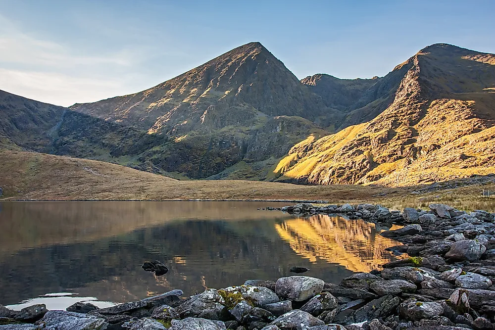
2. Highest Point in Ireland
Carrauntoohil is the highest point in Ireland. The peak lies in County Kerry and is 1,038 meters high. Carrauntoohil is the central peak of Mackgillycuddy's Reeks range. The Scottish Mountaineering Club classifies Carrauntoohil as a Furth. This is generally a mountain that stands higher than 3,000 feet, which is outside Scotland. At times, the peak is referred to as one of the Irish Munros. The mountain's name has different theories of origin and different spelling with the most common name being Carrauntoohil. This is the spelling adopted by the Ordnance Survey Ireland. The mountain is mainly climbed from northeast along the Hag's Glen. Due to loose stones and crowding, the route has become more dangerous to use. No special equipment is required while climbing the mountain. However, climbers are advised to be cautious.
1. Lowest Point in Ireland
The lowest point in the Republic of Ireland is the North Slob. This is an area of mudflats situated at the estuary of River Slaney at the Wexford Harbour in Ireland. The area was reclaimed in the 19th century when a sea wall was built and has an area of 1,000 hectares. North Slob is the lowest point both in Ireland and in the British Isles. Of the reclaimed land, 200 hectares have been set aside as a nature reserve known as the Wexford Wildfowl Reserve. The National Parks and Wildlife Service and Bird Watch Ireland manage the reserve. North Slob serves as a winter home to more than 10,000 white-fronted geese. This forms about 1/3 of the world's population of the geese. In summer months, the geese migrate to Greenland. The area earned international recognition in 1984 with the designation of Wexford Wildfowl Reserve as a Ramsar site. The Guinness World records formally known as Guinness Book of Records have its origin in North Slob.


