What are the Panhandle States?
The word "panhandle" is used to refer to a long, narrow projection of a larger territory that is not a peninsula. In particular, “panhandle” refers to the narrow portion of the state that tugs away from the main state. Although the US has ten panhandles, only nine states have this feature. West Virginia has two panhandles, bringing the number to ten. Here are the panhandle states.
States with Panhandles
West Virginia

West Virginia is the only state with two panhandles; the Eastern and the Northern panhandles. The Eastern Panhandle stretches from the northeastern part of the state and borders the states of Virginia and Maryland. The panhandle includes the lowest and highest elevations in West Virginia and is separated from the rest of the state by the Allegheny Front. It covers about 8 counties including Berkeley, Grant, Hampshire, Hardy Jefferson, Mineral, and Morgan. The Northern Panhandle is the northernmost extension of West Virginia, bordering the state of Pennsylvania and Ohio. The area covers four counties, namely Marshall, Ohio, Brook, and Hancock.
Alaska

The Alaska Panhandle, also referred to as South Alaska, is a protrusion on the southeastern part of Alaska bordering northern British Columbia, Canada. Most parts of the panhandle is contained within the Tongass National Forest, the largest national forest in the US. The area is famous for its beautiful scenery and mild rainy climate and beautiful scenery. The Alaska Panhandle covers about 6.14% of the state’s total area and has a population of about 72,000 people.
Connecticut

The Connecticut Panhandle is the southwestern extension of the state of Connecticut, contained entirely in the Fairfield County. The panhandle resulted from the irregularity in the setting of the boundary line in the 17th century. The Panhandle was a source of a boundary dispute between New York and Connecticut, with the former giving up its claim. A negotiated agreement was reached in November 1683, with 61,660-acre land east of the Byram River making the panhandle.
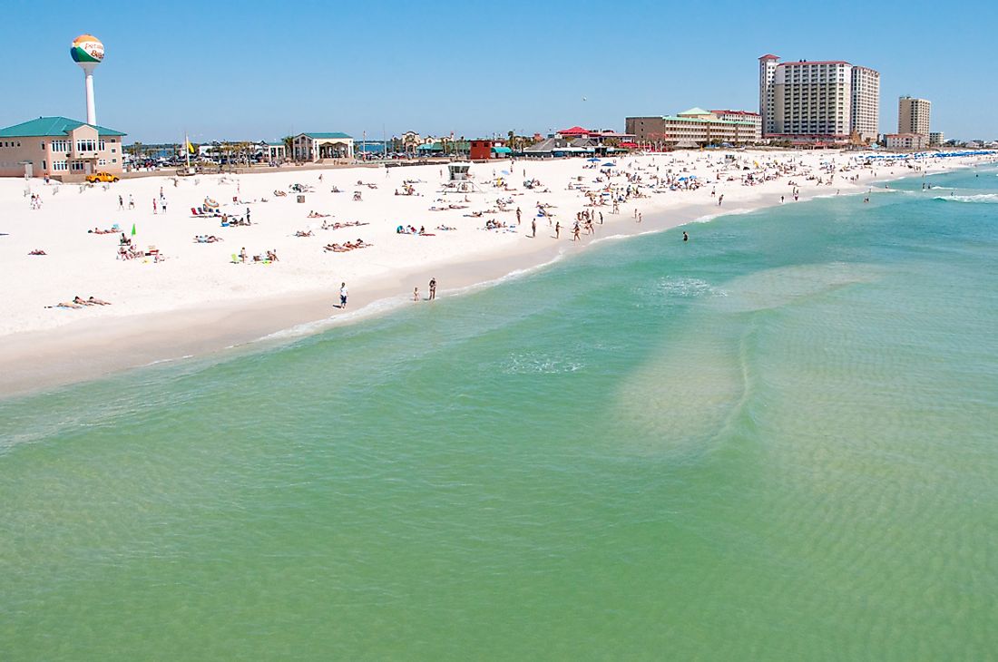
Florida

Florida Panhandle constitutes the northwestern portion of Florida. The panhandle is approximately 200 miles long and 50 miles wide at the narrowest point and 100 miles at the widest point. It is bordered by the states of Alabama and Georgia to the north and west respectively, and to the south by the Gulf of Mexico. The Florida Panhandle includes the ten counties located west of the Apalachicola River. Tallahassee, Florida’s capital, is located in the panhandle.
Idaho

North Idaho, also known as Idaho Panhandle, encompasses the ten northernmost counties of Idaho. It borders the states of Montana and Washington to the west and east respectively and British Columbia to the south. The Idaho Panhandle is part of the Inland Northwest. It has an area of approximately 21,012 square miles or 25.4% of Idaho’s total area. The population within the panhandle is approximately 1.6 million people. Other panhandle states are Maryland, Nebraska, Texas, and Oklahoma.
Protrusions that are Not Considered as Panhandle
Although the state of Utah, like the above mentioned nine states, has a narrow protrusion on the northwestern portion, it is not considered a panhandle state. Salt Lake City, the state’s capital, and its metropolitan area which is the most populous area in the state is located in the region. Other protrusion in the country that are not considered panhandle includes the southern portion of New York. The region is also densely populated.
Panhandle States
| Rank | Panhandle States |
|---|---|
| 1 | Alaska |
| 2 | Connecticut |
| 3 | Florida |
| 4 | Idaho |
| 5 | Maryland |
| 6 | Nebraska |
| 7 | Oklahoma |
| 8 | Texas |
| 9 | West Virginia |


