How Were The Japanese Islands Formed?
Officially known as the State of Japan, Japan is an island country that is located in the eastern region of the Asian continent. The island lies in the Pacific Ocean on the eastern side of mainland Asia. In total, there are 6,853 islands that make up Japan with some of the largest ones including Honshu, Kyushu, Shikoku, and Hokkaido islands. Of the total area of Japan, which is about 145,936.53 square miles, these four large islands make up around 97%. The islands were formed millions of years ago around the Pleistocene as well as the middle parts of the Silurian. Simply put, several massive ocean and plate movements are what led to the formation of the islands. Due to their location in the notorious Pacific Ring of Fire, it is no surprise that the islands are frequently plagued by volcanic and seismic action. For example, in 2011, the country was hit by the destructive Tōhoku earthquake and tsunami, which had a magnitude of 9.0 and ended up killing at least 15,896 people.
Formation of the Japanese Islands
About 750 million years ago, the supercontinent of Rodinia broke and formed the super ocean known as Panthalassa, which is also known as the Panthalassic or Panthalassan Ocean. On the eastern margin of the ocean were some rocks that later on became Japan. Over time, oceanic plates around the area began to undergo the process of subduction with the most recent plate to be subducted being the Izanagi Plate some 95 million years ago. Subduction refers to the process that happens when two tectonic plates come together and one of them is forced to go beneath the other one to become part of the mantle. Currently, the Pacific Plate is undergoing the process of subduction under the Okhotsk Plate albeit at a slow speed of a few centimeters per year. The process of subduction leads to the recycling of the continental crust, which is why most of the rocks in the Japanese archipelago date back the Permian era or beyond. The Permian era began some 47 million years ago, which is relatively young. This first phase is known as the orogeny phase.
Some 23 million years ago, the western side of Japan was actually part of Eurasia’s coastal area. Subduction led to the formation of parts of Japan such as the present-day Kyushu and the Chūgoku region. The subduction process caused a pulling effect that not only formed the aforementioned places but also the Sea of Japan as well as the Sea of Okhotsk. Experts believe that the two seas were formed between 15 and 20 million years ago and had freshwater at first before seawater arrived. In the Miocene era, which was about 16 million years ago, a peninsula was formed on the eastern coast of Eurasia. Present day Hokkaido and Tohoku were formed some 11 million years ago after being lifted from the seabed. Other regions such as the Chubu region were also formed around the same time. Some of the younger parts, which formed around two million years ago, include the Korea Strait, the Kantō Plain, and the Strait of Tartary.
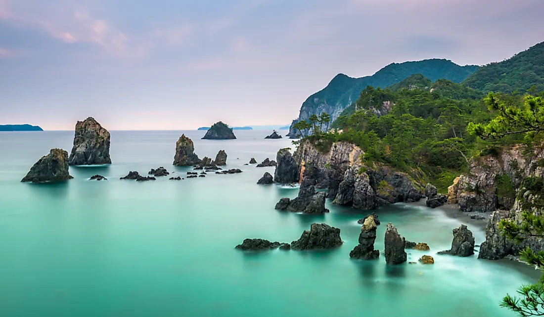
Geological Data
Today, the geological structure and composition of the islands are things that have not yet been comprehended fully. One of the reasons why this is the case is that some parts of the islands have different ages. For example, the parts looking towards the oceanic plates are younger and have more features that are volcanic compared to other parts. On the other hand, the sides facing the Sea of Japan show evidence of heavy faulting and sedimentation. Looking at the northwestern side of the country, geological study is frustrated by thick deposits of from the quaternary era, which goes as far back as around 2.5 million years.
Despite the challenges, experts have grouped the islands into three parts namely Northeastern Japan, Central Japan, and Southwestern Japan. The northwestern part is located on the northern side of the Tanakura fault. The region last experienced volcanic activity between 14 and 17 million years ago. Central Japan is sandwiched by the Itoigawa-Shizuoka Tectonic Line and the Tanakura fault while Southwestern Japan lies on the southern side of the Itoigawa-Shizuoka Tectonic Line.
On the surface, surprisingly, only 0.8% of the country is made up of water despite the country being formed by island. The terrain, about 73%, is covered by mountains, which makes the land unsuitable for things like agriculture, building residential houses, and for industrial use. Consequently, the habitable places, which are mainly around the coastal areas, are extremely populated. In fact, Japan is among the most densely populated nations on the globe.
Geological Hazards
As stated earlier, Japan’s position places it within the notorious volcanic zone known as the Pacific Ring of Fire, which is also known as the circum-Pacific belt. The Ring of Fire has a length of about 25,000 miles and includes several oceanic trenches, plate movements, volcanic belts, and volcanic arcs. Since Japan is part of the ring, the archipelago is prone to destructive earthquakes as well as volcanic activity. In total, 90% of the earthquakes in the world take place along the ring.
Of the total earthquakes in the world, 10% of them happen in Japan. The ongoing subduction between tectonic plates such as the Philippine Sea Plate and the Pacific Plate is the main cause of these earthquakes. In a year, as many as 1,500 earthquakes can occur with most of them having a magnitude of between four and six. One of the most famous earthquakes of all time was the 1923 Great Kantō earthquake where at least 130,000 people passed away. Another one is known as the Great Hanshin earthquake, which occurred in 1995 and killed 6,434 people. Aside from earthquakes occurring on land, they can also occur in the sea and lead to the formation of tsunamis.


