Maps of Samoa

Covering an area of 2,842 sq.km (1,097 sq mi), Samoa is a Polynesian island nation comprising of two large islands of Saval ‘I and Upolu and 8 small islets namely, Manono Island, Apolima and Nu’ulopa; Nu’utele, Nu’ulua, Namua and Fanuatapu; and Nu’usafe’e; located in the South Pacific Ocean. Savai’i is Samoa’s largest island occupying about 1,707 sq.km area. Upolu is the 2nd largest island occupying an area of about 1,119 sq.km and is uneven in shape and more elongated than Savai’i. As observed on the physical map of Samoa above, the two large islands are mountainous, volcanic in origin and covered with heavy forests. The highest point is Mt. Sisisili on Savai’i Island which peaks at an elevation of 6,070ft (1,857m) and is marked on the map above by a yellow triangle. The islands are ringed by coral reefs and shallow lagoons.
Districts of Samoa Map

Samoa (officially, the Independent State of Samoa) is divided into 11 administrative districts. These districts are: A’ana, Aiga-i-le-Tai, Atua, Fa’asaleleaga, Gaga’emauga, Gagaifomauga, Palauli, Satupa’itea, Tuamasaga, Va’a-o-Fonoti and Vaisigano.
Covering an area of 2,842 sq.km, Samoa is a Polynesian island nation comprising of two large islands of Saval ‘I and Upolu and 8 small islets namely, Manono Island, Apolima and Nu’ulopa; Nu’utele, Nu’ulua, Namua and Fanuatapu; and Nu’usafe’e; located in the South Pacific Ocean.
Located on the northern coast of Upolu Island, on a natural harbor at the mouth of Vaisigano River is, Apia – the capital and the largest city of Samoa. It serves as the main port and the administrative and commercial center in Samoa.
Where is Samoa?

Samoa is a Polynesian island nation comprising of two large islands of Saval ‘I and Upolu and 8 small islets, located in the South Pacific Ocean. Samoa is situated roughly halfway between Hawaii and New Zealand. Samoa lies to the south of the Equator and is geographically positioned in the Western hemisphere and Southern hemisphere of the Earth. It is located to the west of American Samoa, to the northeast of New Zealand and to the southwest of Hawaii.
Regional Maps: Map of
Outline Map of Samoa

The above blank map represents Samoa - a Polynesian island nation comprising of two large islands of Saval ‘I and Upolu and 8 small islets, located in the South Pacific Ocean. The above map can be downloaded, printed and used for geography education purposes like map-pointing and coloring activities.

The above outline map represents Samoa - a Polynesian island nation comprising of two large islands of Saval ‘I and Upolu and 8 small islets, located in the South Pacific Ocean.
Key Facts
| Legal Name | Independent State of Samoa |
|---|---|
| Flag |
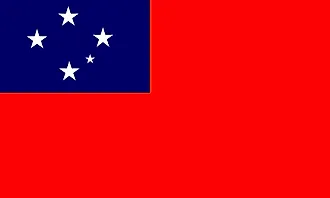
|
| Capital City | Apia |
| 13 49 S, 171 46 W | |
| Total Area | 2,831.00 km2 |
| Land Area | 2,821.00 km2 |
| Water Area | 10.00 km2 |
| Population | 197,097 |
| Currency | Tala (SAT) |
| GDP | $850.66 Million |
| GDP Per Capita | $4,315.92 |
This page was last updated on November 23, 2020