Society Islands
- French Polynesia is an Overseas Collectivity of France that is made up of 118 islands and atolls scattered over a vast area in the Pacific Ocean.
- The Society Islands is an archipelago of 14 islands that are geographically and administratively divided into two separate clusters. The two island clusters are the Windward Islands and the Leeward Islands.
- The Windward Islands form the eastern part of the archipelago and include about 5 islands whereas the Leeward Islands form the western part of the archipelago and include about 9 islands.
French Polynesia is an Overseas Collectivity of France that is situated nearly halfway between the South American and the Australian landmasses. French Polynesia is a part of Oceania and is made up of 118 islands and atolls which are scattered over an area of more than 2,500,000 km2 in the south-central Pacific Ocean. The islands and atolls of French Polynesia are geographically divided into five island groups, namely Austral, Gambier, Marquesas, Society, and Tuamotu.
Geography

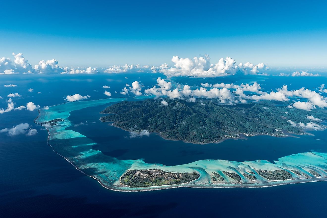
Covering a land area of about 1,590 km2, the Society Islands is an archipelago of 14 islands that politically form a part of French Polynesia. The archipelago is both geographically and administratively divided into two volcanic and coral island clusters that extend for about 725 km. The two island clusters are known as the Windward Islands and the Leeward Islands.
With an area of 1,195 km2, the Windward Islands (Îles du Vent) form the eastern portion of the Society Islands archipelago. The Windward Islands group is composed of the islands of Maiao, Mehetia, Moorea, Teti'aroa, and Tahiti.
With an area of 395 km2, the Leeward Islands (Îles Sous-le-vent) form the western portion of the Society Islands archipelago. The Leeward Islands group is made up of the islands of Bora Bora, Huahine, Manuae, Motu One, Mopelia, Maupiti, Raiatea, Tupai, and Taha’a.

Most of the islands of the Society Islands group are volcanic in origin and are fringed by coral reefs. The islands in this group feature green specs of land with numerous toothy-edged peaks. Located in the Windward Island group, Tahiti is the largest and the most populous island in French Polynesia. Situated on the northwestern coast of the Tahiti island is Papeete, which serves as the administrative capital of French Polynesia. Also located in the central part of Tahiti Island is Mont Orohena, which rises to an elevation of 2,241 m and is the highest point on French Polynesia.
With a land area of 167.7 km2, Raiatea is the largest and the most populous island in the Leeward Islands group. This volcanic and mountainous island is the second-largest island in French Polynesia.
Coconut palms, pandanus trees, and breadfruit trees cover the landscape of the rugged Society Islands. Rats, wild pigs, and lizards are some of the faunal species that are found in the islands. Commercial products like Tahitian pearls, sugar, copra, and rum are exported from these islands.
Brief History

It is believed that by the year 800 AD, the Polynesians had arrived on the Society Islands. In 1767, the English navigator Captain Samuel Wallis visited Tahiti Island and claimed all the islands for Great Britain. In 1768, the French navigator Louis Antoine de Bougainville claimed these islands for France. During his visit to the islands in 1769, Captain James Cook named these islands in the honor of the Royal Society of Britain that sponsored the scientific exploration of these islands. In 1843, the Society Islands became a protectorate of France and in 1880, they became a French colony of the French Establishments of Oceania. From 1946, both the Windward and Leeward Islands of the Society Islands group became administrative divisions of French Polynesia.


