Maps of Fiji
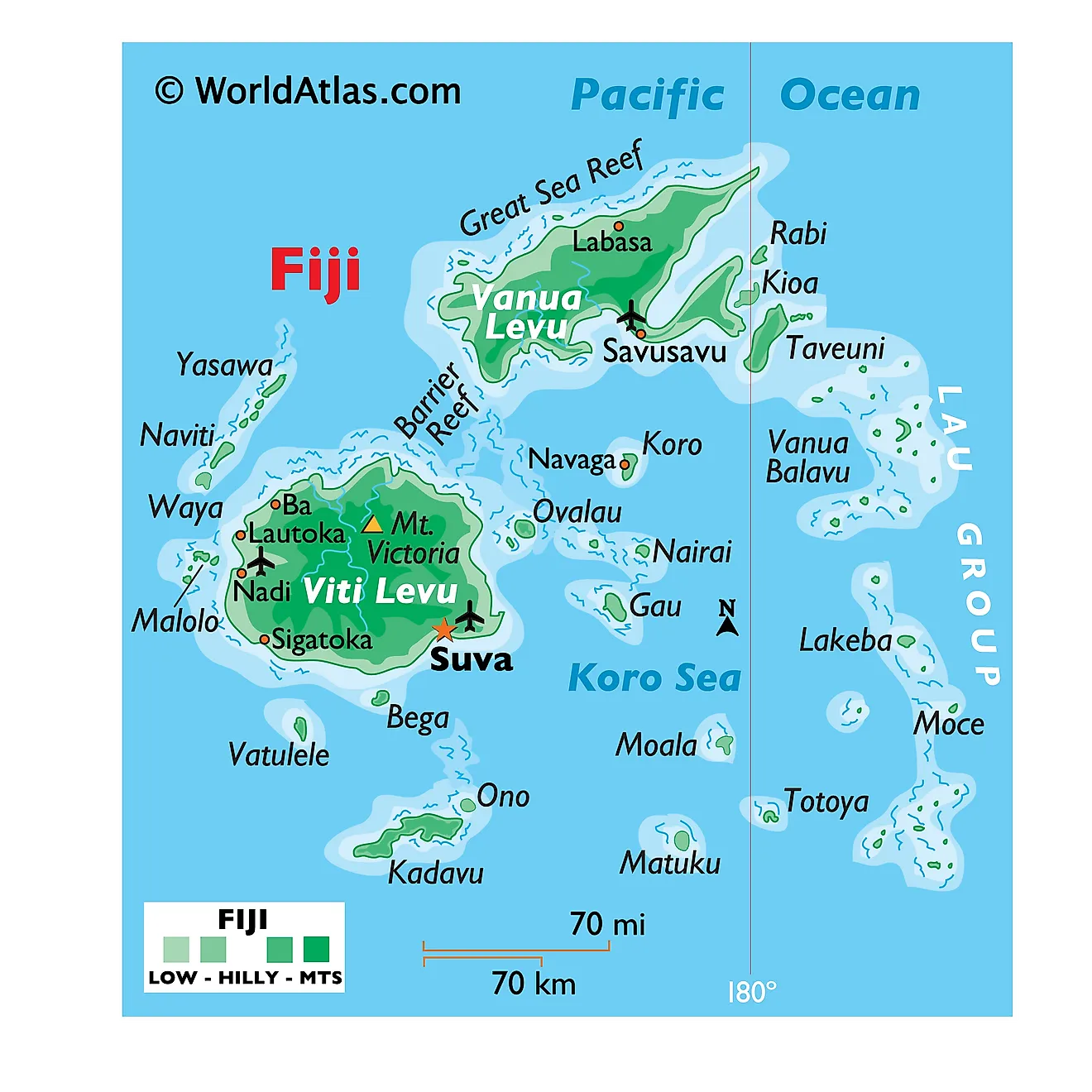
Fiji lies in the south Pacific Ocean, to the northeast of New Zealand and southwest of Hawaii. It does not share land borders with any other country. The country encompasses an area of about 18,274 km2 (7,056 mi2).
Viti Levu: Viti Levu is the largest island in Fiji, accounting for over half of the country’s total land area. This region is characterized by a rugged terrain, with a central mountain range that includes the country’s highest peak, Mount Tomanivi, standing at 1,324 m (4,344 ft). The island's eastern side receives significant rainfall, supporting lush tropical rainforests. In contrast, the western side, in the rain shadow of the central mountains, has drier grasslands and sugarcane fields. Lastly, the Sigatoka River is one of Fiji’s major rivers and it flows through the island.
Vanua Levu: To the north of Viti Levu lies Fiji’s second-largest island, Vanua Levu. This island also has a rugged interior, though less mountainous compared to Viti Levu. The Dreketi River, the largest on Vanua Levu, meanders through its landscapes. Vanua Levu's coastal areas feature mangrove forests, while its surrounding waters have coral reefs. Inland, the island boasts vast tracts of tropical rainforests and coconut plantations.
Taveuni and Kadavu: Taveuni, known as the Garden Island, stands as the third-largest island in Fiji. It is renowned for its pristine rainforests and is home to the Bouma National Heritage Park. The island also has an extensive network of freshwater streams. Kadavu, to the south of Viti Levu, is a significant island characterized by its largely unspoiled environment. The Great Astrolabe Reef, one of the world's largest barrier reefs, extends along the southern coast of Kadavu.
Smaller Islands and Atolls: Beyond these major islands, Fiji consists of numerous smaller islands and atolls, that are mostly inhabited. The Yasawa Group, located to the northwest of Viti Levu, comprises a series of volcanic islands with striking landscapes and beautiful beaches. The Mamanuca Group, closer to Viti Levu, features some of Fiji's most iconic island resorts and crystal-clear waters. Meanwhile, the Lau Group, to the far east, consists of a series of atolls and islands.
Divisions of Fiji Map
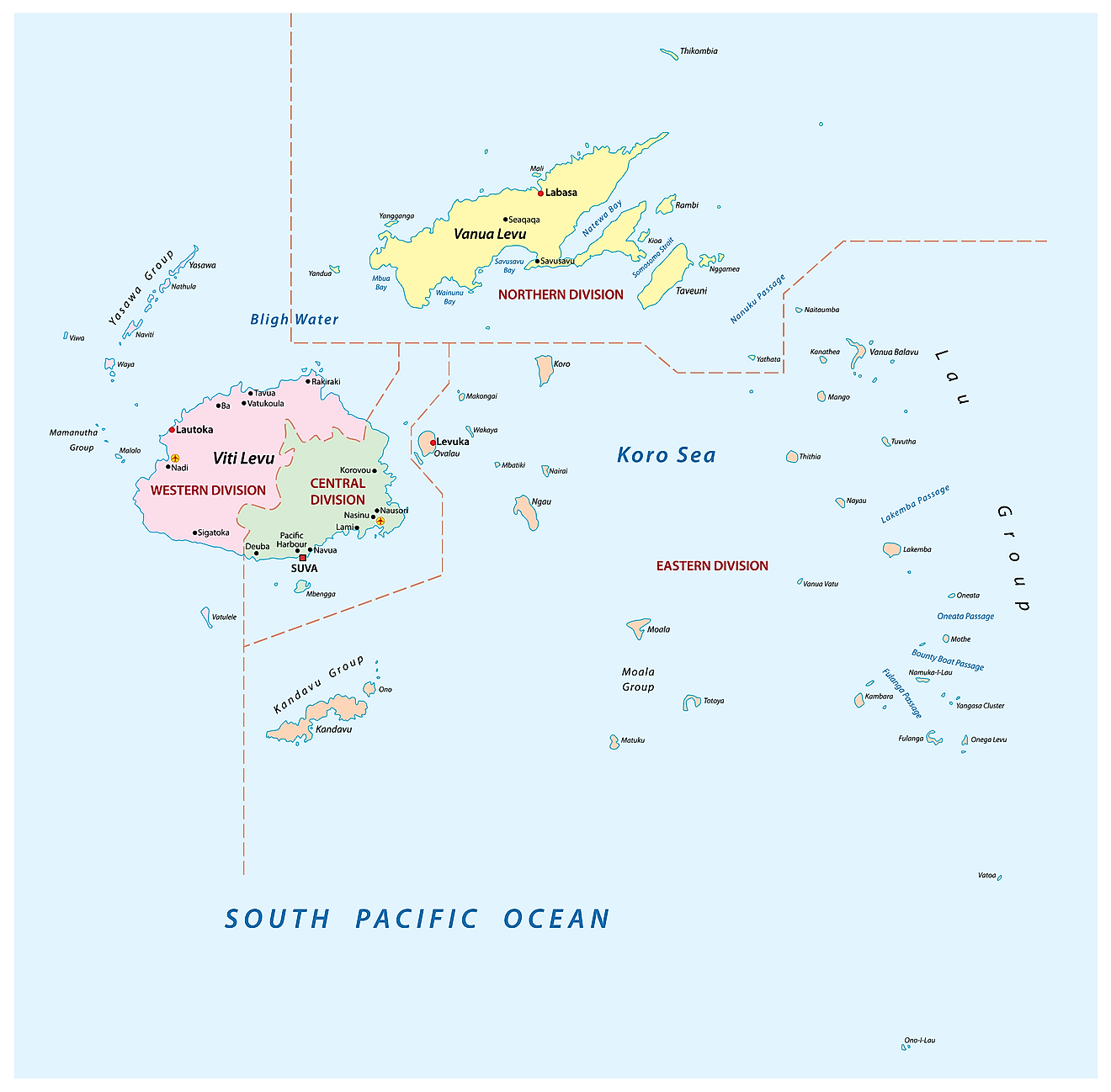
Fiji (officially, the Republic of Fiji) is administratively divided into 4 divisions which are further subdivided into 14 provinces and 1 self-governing dependency. The 4 divisions are: Central Division, Northern Division, Eastern Division and Western Division. In alphabetical order, the provinces are: Ba, Bua, Cakaudrove, Kadavu, Lau, Lomaiviti, Macuata, Nadroga and Navosa, Naitasiri, Namosi, Ra, Rewa, Serua and Tailevu. Rotuma is a self-governing dependency. The provinces are further divided into 17 districts and 5 sub-districts.
Covering an area of 18,300 sq.km, the island nation of Fiji is an archipelago of more than 330 islands and 500 islets; with Viti Levu and Vanua Levu being the two largest and the most populated islands. Located on the southeastern coast of Viti Levu (Fiji’s principal island) is Suva – the capital and the largest city of Fiji, as well as one of the largest urban centers in the South Pacific islands. Suva is also the chief port and the administrative, cultural, economic and commercial center of the country. Lautoka is the 2nd largest city in Fiji.
Where is Fiji?
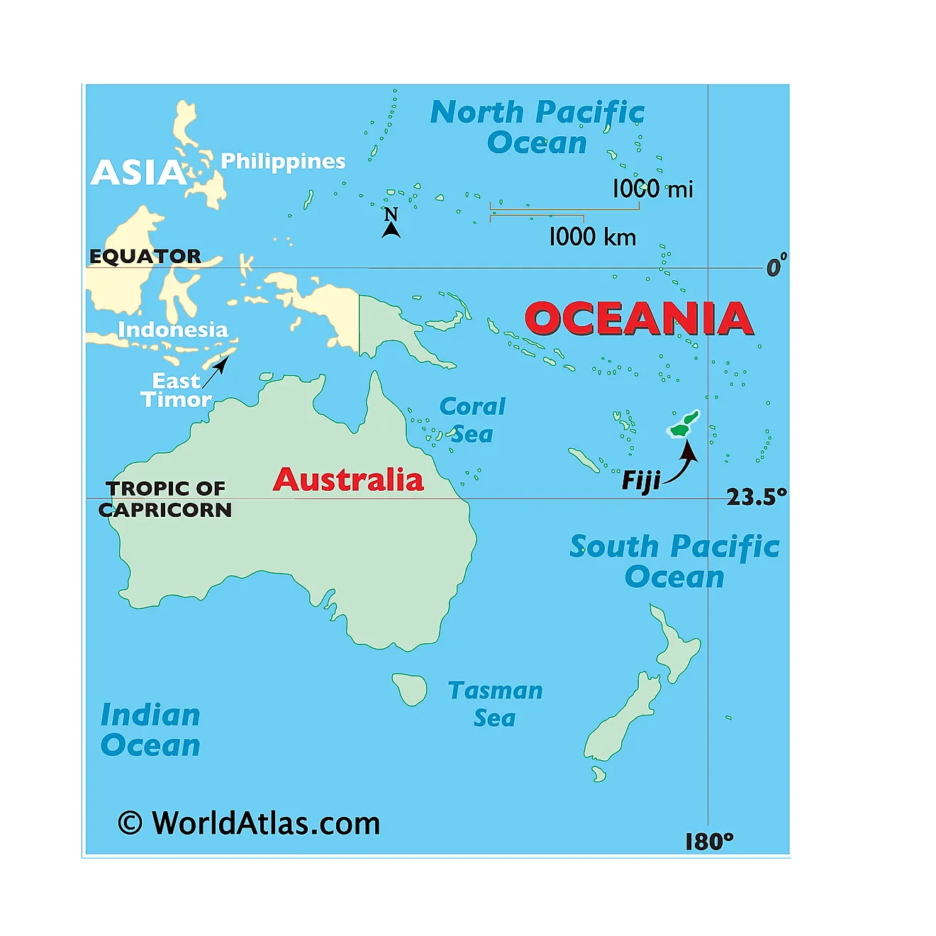
Fiji is an island country in Melanesia and an archipelago in the Southern Pacific Ocean, as a part of the continent of Oceania. It is geographically positioned both in the Southern and Eastern hemispheres of the Earth. Fiji is situated in the northeast of Australia; in the north of New Zealand and is completely surrounded by the Pacific Ocean. Its closest neighbors are: Vanuatu to the west; New Caledonia to the southwest; New Zealand’s Kermadec Islands to the southeast; Tonga to the east; the Samoa and France’s Wallis and Futuna to the northeast and Tuvalu to the north.
Regional Maps: Map of Oceania
Outline Map of Fiji
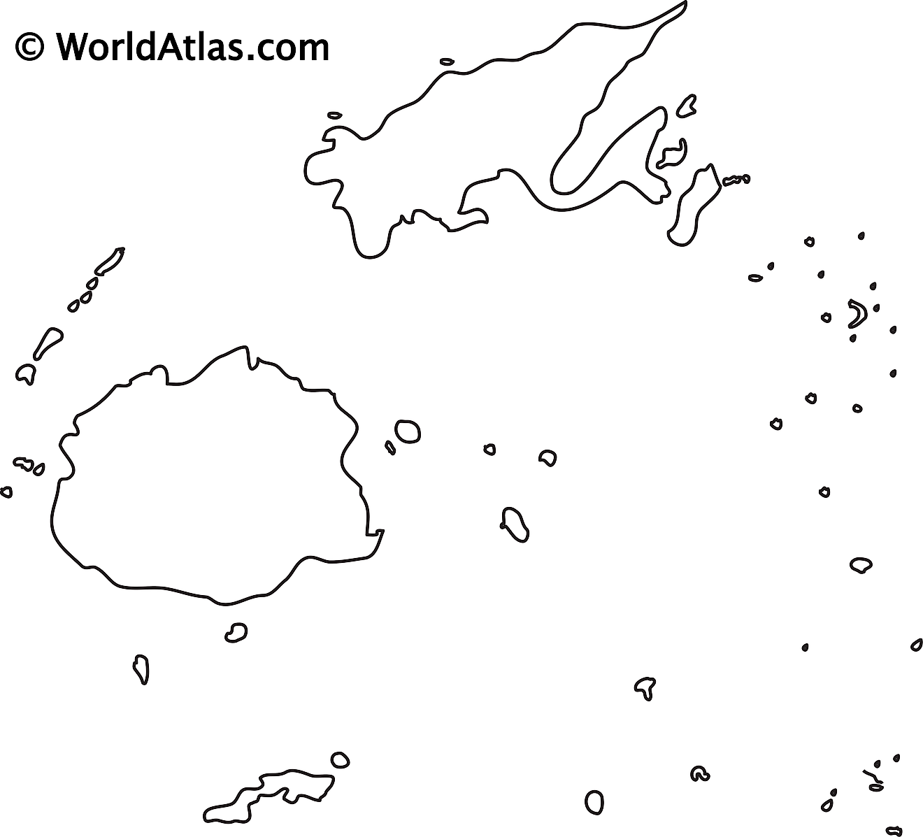
The above blank map represents Fiji – a Melanesian country, an archipelago and a part of Oceania in the South Pacific Ocean. The above map can be downloaded, printed and used for geography education purposes like map-pointing and coloring activities.
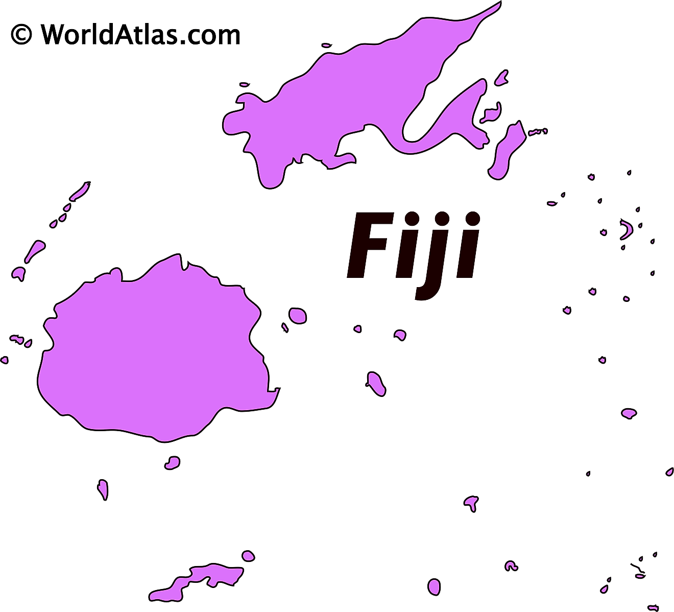
The above outline map represents Fiji – a Melanesian country, an archipelago and a part of Oceania in the South Pacific Ocean.
Key Facts
| Legal Name | Republic of Fiji |
|---|---|
| Flag |
|
| Capital City | Suva (on Viti Levu) |
| 18 08 S, 178 25 E | |
| Total Area | 18,274.00 km2 |
| Land Area | 18,274.00 km2 |
| Water Area | N/A |
| Population | 889,953 |
| Currency | Fijian dollars (FJD) |
| GDP | $5.54 Billion |
| GDP Per Capita | $6,220.05 |
This page was last updated on August 15, 2023
