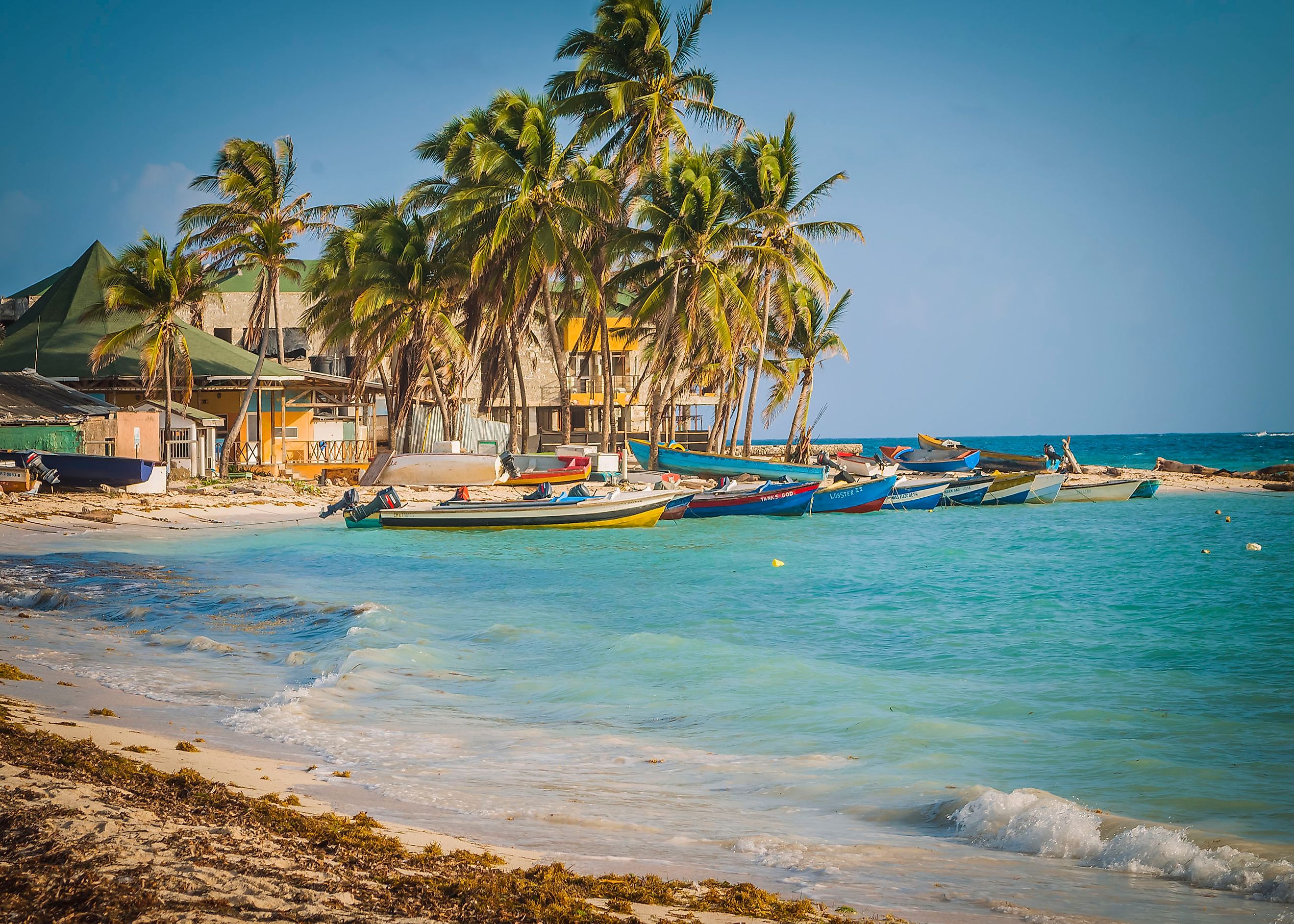
San Andrés Island
The Republic of Colombia, a country located in the northwestern part of the Continent of South America is administratively divided into a total of 32 departments and one capital district. The Archipelago de San Andrés, Providencia y Santa Catalina is one such department of Colombia which includes the islands of San Andrés, Providencia, and Santa Catalina.
The large coral island of San Andrés is in the Caribbean Sea, about 80 km south of Providencia, 750 km northwest of the Colombian mainland, and 200 km east of the Central American mainland.
Geography

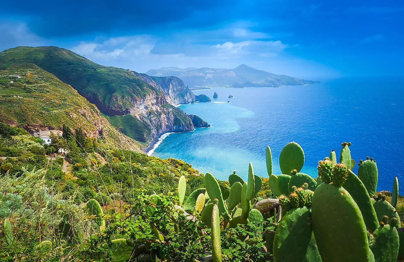
With an area of 26 km2, San Andrés is the largest island in the Colombian archipelago. The island measures 13 km in length and has a maximum width of 3 km. The San Andrés Island features a relatively flat terrain with the island’s highest point rising to an elevation of only 55 m. A small mountain range crisscrosses the island from south to north with Cerro La Loma (El Cliff) being its highest peak. The San Andrés island is composed of fertile red clay soil and geological studies of this soil have revealed that the island was formed due to volcanic eruption that resulted in the deposition of these older rocks on the sea surface.
The central portion of the island features many small hills like the Lion’s, Shingle, Flower, and Orange Hills. The entire island is mainly covered by grass and trees, and sandy beaches are found lining the coastline in the island’s northern part. There are no major rivers on the island.
Some rocky features, namely Fisher Rock, Bobby Rock, Tyler Rock, and Boobie Rock are found on the southwestern part, while Rock Point is found on the southeastern part of the island. A small coral reef surrounds the island on its northwestern part. Several sandbanks and small cays are also found here including Johnny Cay, Rocky Cay, Haynes Cay, El Acuario Cay, and Coton Cay.
The San Andrés Island experiences a tropical climate with high temperatures throughout the year that is moderated by the trade winds that continuous blow over the island. The San Andrés island faces a high humid wet season from May to January.
Wildlife

The San Andrés Island is covered by mangrove forests as well as various trees like breadfruit, coconut palms, local trees, and lush green pastures. It is estimated that about 12 mangrove forests of different mangrove species are found on the island. The critically endangered San Andrés bird is endemic to the islands of the Colombian archipelago. Some other avian species that are observed here include the white-winged dove, black-faced grassquit, yellow warbler, tropical mockingbird, and black-whiskered vireo. Numerous crabs and oysters are also found in the waters surrounding the San Andrés Island. Many species of corals like brain coral, star coral, elkhorn coral, staghorn coral, and finger coral are found on the shores of the island. The Jamaican fruit bat is the only mammal found on San Andrés Island. The entire archipelago was designated as a UNESCO Biosphere Reserve under the name of “Seaflower Biosphere Reserve” in 2000.
Brief History

It is believed that the islands of the Colombian Archipelago were first settled by the Dutch during the late 16th century. The English Puritans occupied the islands and subsequently removed the Dutch settlers from the island in 1631. Starting around 1633, the English began to bring Black slaves from Jamaica to work in the cotton and sugar plantations. The San Andrés Island was attacked by the Spanish in 1635. However, the British successfully evicted the Spaniards from the island. It is believed that the island was a favorite spot for many buccaneers and the English privateer Sir Henry Morgan had set up his base on the island in 1670. The Spanish ships carrying precious materials were attacked by these pirates. According to a legend, Henry Morgan buried a portion of his treasure on the San Andrés Island in the underwater Morgan’s Cave.
The islands remained under the control of the British till 1787, after which they were handed over to Spain. In 1803, Spain assigned the islands to the Viceroyalty of New Granada. Simón Bolívar occupied the island in 1818. In 1822, after Spanish colonies across the Caribbean and South America became independent, the inhabitants of the islands of San Andrés, Providence, and Santa Catalina joined the Republic of Gran Colombia. However, Nicaragua laid claims on the islands due to their close proximity. A treaty between Nicaragua and Colombia was signed in 1928, which gave control of the islands to Colombia. The archipelago became a Special Municipality in 1972 and in 1991, it officially became a Department of Colombia.