Maps of Haiti
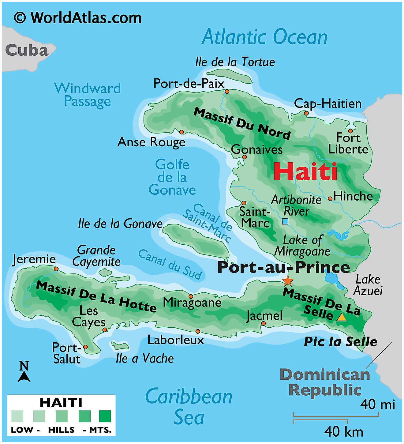
Haiti, occupying the western third of the island of Hispaniola in the Greater Antilles archipelago, is bounded to the east by the Dominican Republic, its only terrestrial neighbor. The northern coastlines meet the Atlantic Ocean, while to the south, the country is washed by the Caribbean Sea. Haiti spans approximately 10,714 square miles (27,750 square kilometers), making it the third-largest country in the Caribbean by land area.
Haiti is divided into three principal geographical regions: the northern region, the central region, and the southern region. These regions are characterized by considerable diversity, including mountainous areas, coastal plains, and numerous small islands.
The northern region of Haiti includes the Northern Plain and the Northern Massif. The Northern Plain extends along the northern coast, offering fertile land suitable for agriculture. The Northern Massif, part of the mountain chain known as the Massif du Nord, stretches along the Dominican border. These mountains are characterized by rugged terrain and peaks exceeding 4,000 feet (1,220 meters).
Central Haiti is dominated by two major mountain ranges, the Massif de la Selle and the Massif de la Hotte, which make up the bulk of the Hispaniola highlands. The Massif de la Selle, the larger of the two ranges, features Pic la Selle, the country's highest peak at 8,793 feet (2,680 meters). The Massif de la Hotte contains Pic Macaya, the second-highest peak, standing at 7,700 feet (2,347 meters). These ranges are known for their extensive biodiversity, including many endemic species.
The southern region of Haiti features the Southern Peninsula, which extends into the Caribbean Sea and is lined by a narrow coastal plain and low mountains.
Haiti is home to several notable bodies of water. The largest lake in the country, Étang Saumâtre, also known as Lake Azuéi, lies on the border with the Dominican Republic. This brackish body of water covers roughly 65 square miles (170 square kilometers). The Artibonite River, the longest in Haiti and the island of Hispaniola, has its source in the Cordillera Central in the Dominican Republic, crossing Haiti's central plateau and flowing into the Gulf of Gonâve.
The Gulf of Gonâve, the largest gulf of the country, lies between the Northern and Southern Peninsulas of Haiti. Several smaller islands are found within the Gulf, the largest being Gonâve Island.
In addition to its principal geographical regions and bodies of water, Haiti also includes numerous smaller islands such as Tortuga, Île-à-Vache, and the Cayemites.
Departments of Haiti Map
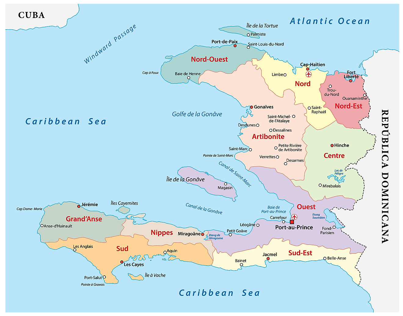
Haiti (officially, the Republic of Haiti) is divided into 10 departments. In alphabetical order, these departments are: Artibonite, Centre, Grand’Anse, Nippes, Nord, Nord-Est, Nord-Ouest, Ouest, Sud, Sud-Est. These departments are further subdivided into 42 arrondissements, 145 communes and 571 communal sections.
Covering an area of 27,750 sq. km, Haiti is the 3rd largest and the most populous nation in the Caribbean. Located on a bay at the top of the Gulf of Gonave is, Port-au-Prince – the capital, the largest and the most populous city of Haiti. It is a major port, administrative and commercial center of the country.
Where is Haiti?
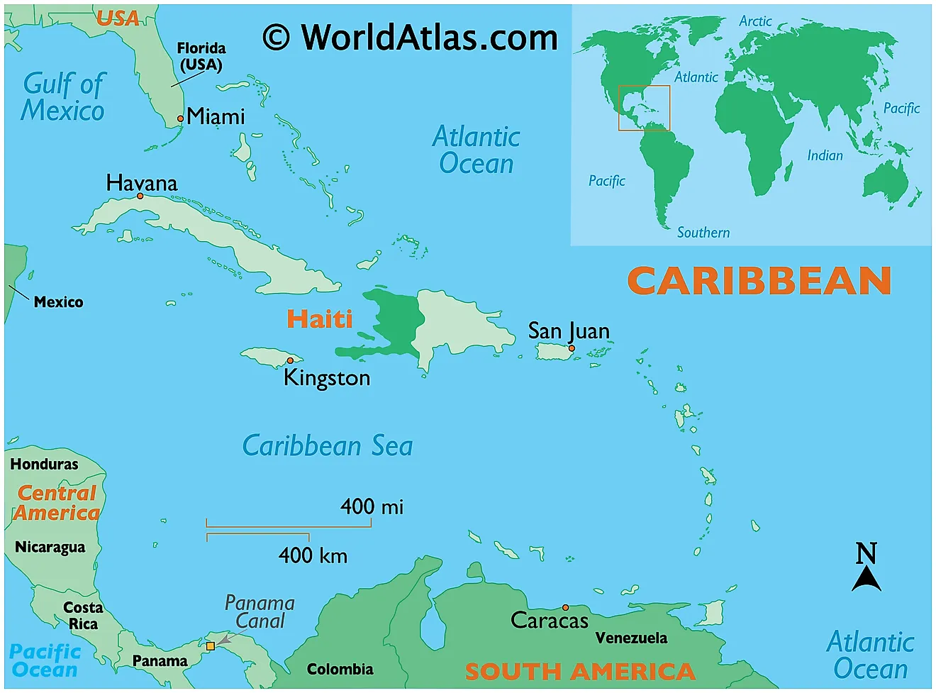
Haiti is a large mountainous country located in the north-central Caribbean; occupying the western third of the Island of Hispaniola in the Greater Antilles archipelago. It is positioned in the Northern and Western hemispheres of the Earth. Haiti lies to the east of Cuba and Jamaica and to the south of The Bahamas and the Turks and Caicos Islands. The country is bordered to the east by the Dominican Republic; to the west and south by the Caribbean Sea; and to the north by the Atlantic Ocean.
Haiti Bordering Countries: The Dominican Republic.
Regional Maps: Map of North America
Outline Map of Haiti
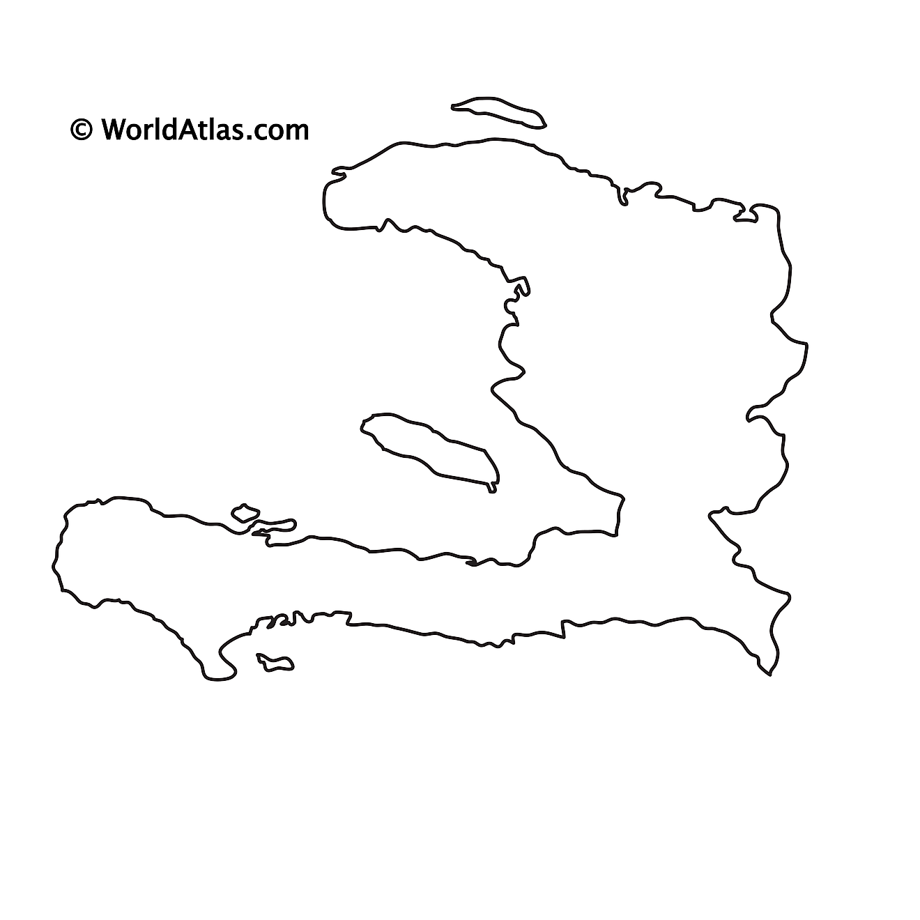
The above blank map represents Haiti, the 3rd largest country in the Caribbean. The above map can be downloaded, printed and used for educational purposes.
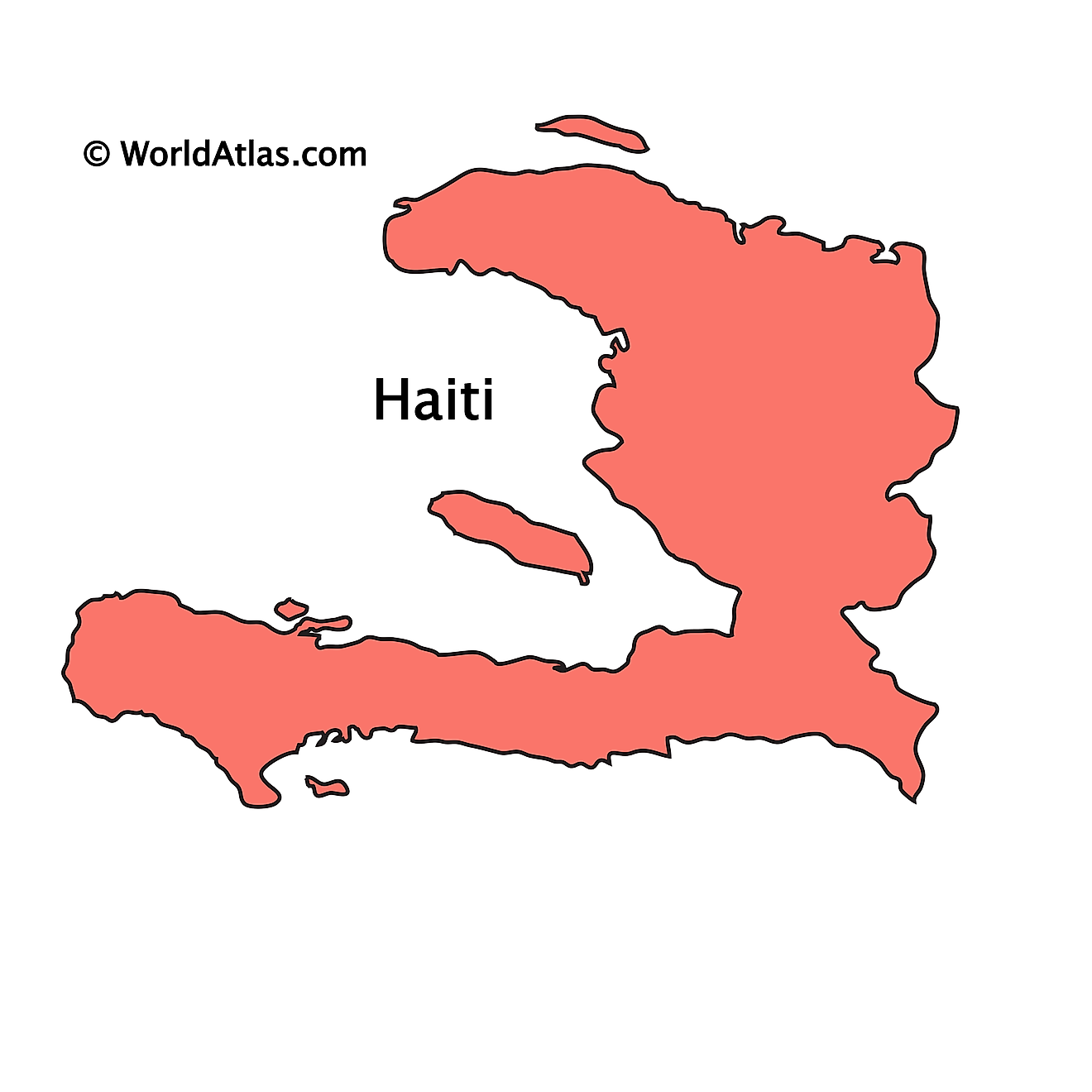
The above outline map represents Haiti – a large, mountainous country in the Caribbean Sea. Its disproportionately long coastline gives it a horseshoe shape appearance.
Key Facts
| Legal Name | Republic of Haiti |
|---|---|
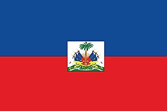
| Flag |
|
| Capital City | Port-au-Prince |
| 18 32 N, 72 20 W | |
| Total Area | 27,750.00 km2 |
| Land Area | 27,560.00 km2 |
| Water Area | 190.00 km2 |
| Population | 11,263,077 |
| Largest City |
Port-au-Prince (2,987,455) |
| Currency | Gourdes (HTG) |
| GDP | $8.50 Billion |
| GDP Per Capita | $754.59 |
This page was last updated on June 19, 2023


