Maps of San Marino

With its land area covering only 24 sq miles (61 sq km), San Marino is one of the smallest countries in Europe after the Vatican and Monaco.Landlocked and surrounded by Italy, the country is in the Appennines Mountains region, with most of it on the slopes of Mt. Titano. At 2,477 feet (755 m) Monte Titano is San Marino's highest point. It has been marked on the map by a yellow upright triangle. Some of the rivers like San Marino River, Fiumicello River, and Ausa River flowing through San Marino have been shown on the map.The lowest point in the country is located in the Ausa River at 55 m.
Municipalities of San Marino Map

San Marino (officially, the Republic of San Marino) is divided into 9 municipalities (castelli, sing. castello). In alphabetical order, these municipalities are: Acquaviva, Borgo Maggiore, Chiesanuova, Domagnano, Faetano, Florentino, Montegiardino, San Marino Citta and Serravalle.
With an area of 61 sq. km, San Marino is the 3rd smallest and the oldest independent state in Europe. San Marino is the 5th smallest country in the world. Located on the western side of Monte Titano, is San Marino City (The City of San Marino) – the capital city of San Marino. Dogana is the most populated and the largest settlement of San Marino.
Where is San Marino?

San Marino is a landlocked enclave in Southern Europe. It is positioned in the Northern and eastern hemispheres of the Earth. San Marino is situated in the south-central region of the European continent, on the slopes of Monte Titano in the Apennine Mountains on the Italian Peninsula. San Marino is surrounded on all sides by Italy.
San Marino Bordering Countries: Italy.
Regional Maps: Map of Europe
Outline Map of San Marino


Key Facts
| Legal Name | Republic of San Marino |
|---|---|
| Flag |
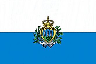
|
| Capital City | San Marino (city) |
| 43 56 N, 12 25 E | |
| Total Area | 61.00 km2 |
| Land Area | 61.00 km2 |
| Water Area | N/A |
| Population | 33,860 |
| Currency | Euros (EUR) |
| GDP | $1.64 Billion |
| GDP Per Capita | $48,481.01 |
This page was last updated on February 24, 2021