Maps of Guinea-Bissau
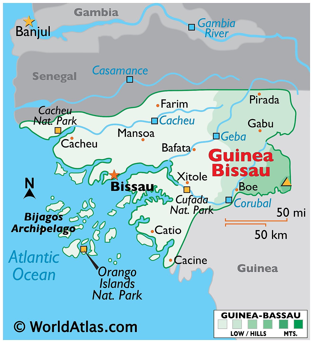
Guinea-Bissau is a West African country with an area of 36,125 sq. km. One of the smallest nations in all of Africa, Guinea-Bissau is bordered by two other countries. Guinea encompasses the southern border while Senegal looms large in the north. Guinea-Bissau's environment is largely made up of swamps and marshlands that tend to spring up around the nation's many waterways. In the east, savannah forests start to appear the closer you get into the interior.
The Atlantic Ocean plays a significant role in both the geography and culture of Guinea-Bissau. Most of the large urban centers of the country can be found along the coastline. Fishing is a huge local industry in Guinea-Bissau and the nation has long developed an identity and culture around the ocean.
Guinean mangrove swamps make up large swaths of the interior. Most of Guinea-Bissau is low-lying. Due to the flat nature of the terrain, tidal waters reach as far as 100 km inland. The Corubal, Geba, and Cacheu Rivers are some of the major waterways draining Guinea-Bissau and have been marked on the map. Off the coast of Guinea-Bissau, is the Bijagos Archipelago. It is a group of some eighteen major islands and dozens of smaller ones that extend along the Atlantic Ocean coastline. The Orango Islands National Park is its main attraction.
The Fouta Djallon Plateau dominates the southeastern part of the country. With an elevation of around 180 m, gentle hills, and small mountains are common in this region. From the western slopes of this plateau, Boe hills arise and extend westwards for a short distance. The highest point of the country is an unnamed hill at 984 ft (300 m); the lowest point of Guinea-Bissau is the Atlantic Ocean (0 m).
Guinea-Bissau Regions Map
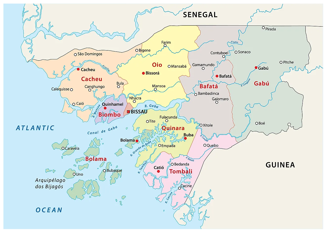
Guinea-Bissau has 8 regions and one autonomous sector. The regions are further subdivided into 37 sectors which are in turn made up of sections that comprise of towns, villages, localities, etc.
The regions of the country are Bafata, Biombo, Bolama/Bijagos, Cacheu, Gabu, Oio, Quinara, and Tombali. Bissau, the capital of the nation is an autonomous sector. With an area of 9,150.0 sq. km, Gabu is the largest region of Guinea-Bissau by area.
Where is Guinea-Bissau?
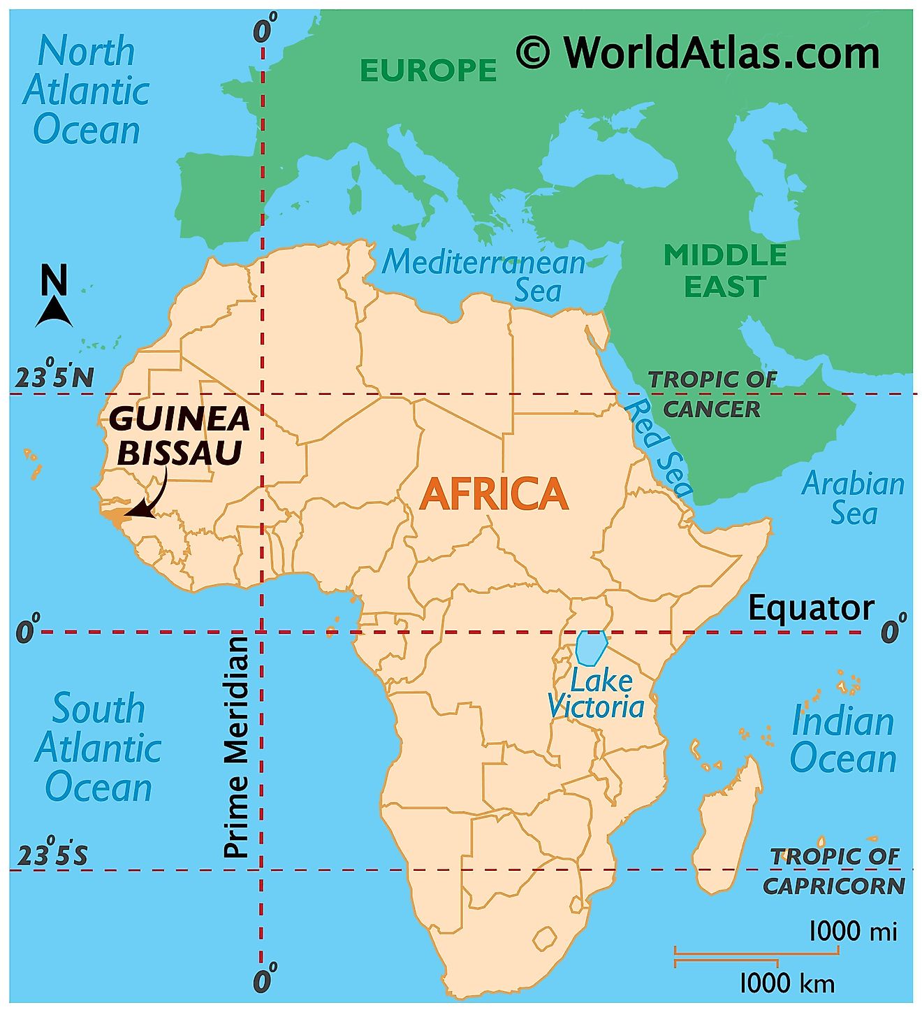
The West African country of Guinea-Bissau is one of the smallest in the continent. It is located in the Northern and Western Hemispheres of the Earth. Only two countries border Guinea-Bissau. Senegal bounds it to the north while its easterna and southern boundaries are with Guina. To the west, the country has a coastline on the Atlantic Ocean.
Guinea-Bissau Bordering Countries: Senegal, Guinea.
Regional Maps: Map of Africa
Outline Map of Guinea-Bissau
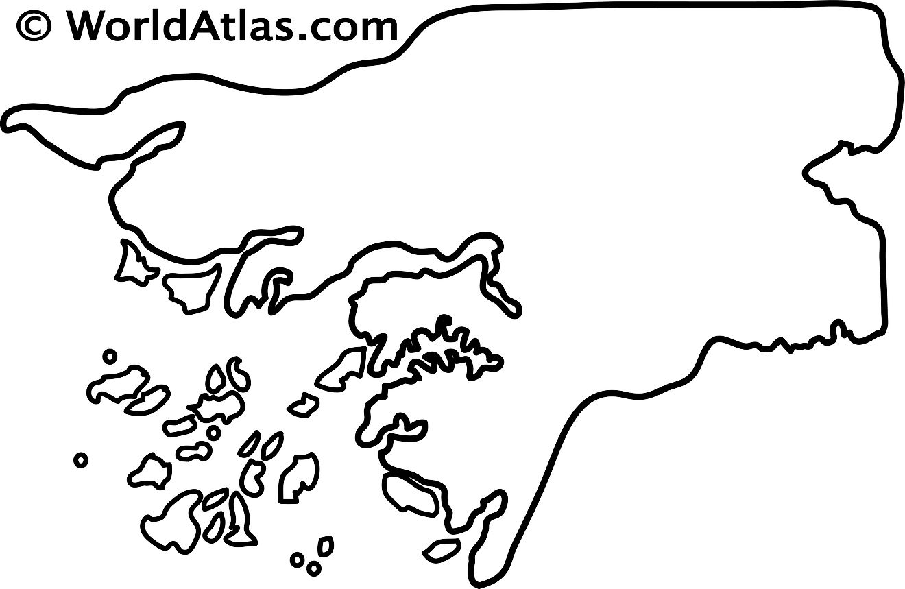
The blank outline map represents the West African country of Guinea-Bissau and its islands in the Atlantic Ocean. The map can be downloaded and used for educational purposes like map-pointing activities or for coloring.
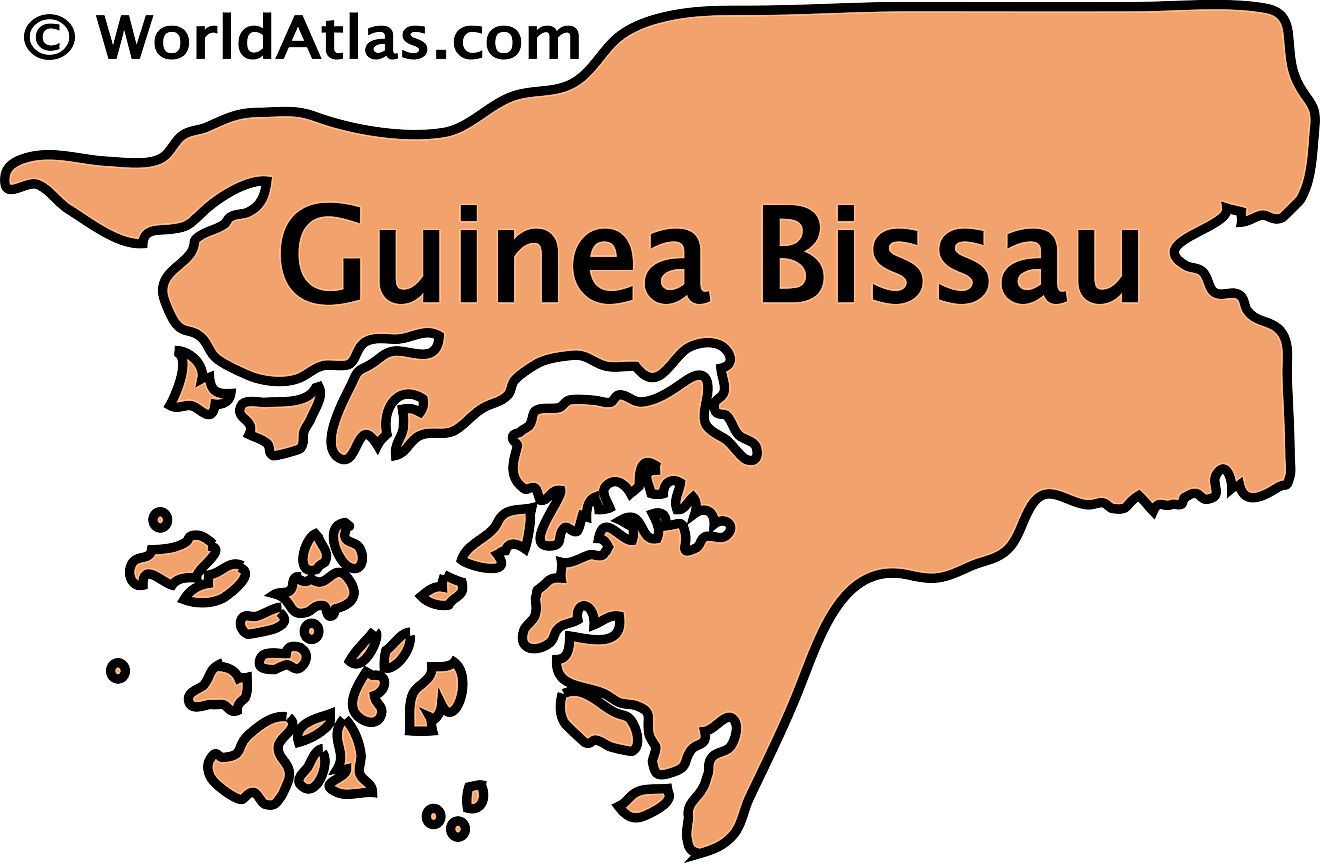
The outline map represents the West African sovereign country of Guinea-Bissau with its islands in the Atlantic Ocean. The coastline of the country appears to be highly indented.
Key Facts
| Legal Name | Republic of Guinea-Bissau |
|---|---|
| Flag |
|
| Capital City | Bissau |
| 11 51 N, 15 35 W | |
| Total Area | 36,125.00 km2 |
| Land Area | 28,120.00 km2 |
| Water Area | 8,005.00 km2 |
| Population | 1,920,922 |
| Largest City |
Bissau (664,446) |
| Currency | Communaute Financiere Africaine francs (XOF) |
| GDP | $1.34 Billion |
| GDP Per Capita | $697.78 |
This page was last updated on June 24, 2025

