The Best State Parks In Appalachia
Appalachia's national parks get the crowds, but its state parks hold the best scenery. These are the gorges the mountains cut deepest and the peaks they pushed highest. Blackwater Falls stains its water tea-dark with tannins off the hemlocks upstream. Grayson Highlands hands its high balds to wild ponies that keep the grass short. The rest guard moonbows, thousand-foot canyons, and the tallest summit in the eastern US.
Blackwater Falls State Park, West Virginia

The amber cascade of Blackwater Falls drops 57 feet into a narrow gorge, creating one of the most photographed scenes in West Virginia. The water's distinctive tea color results from tannic acid, a natural compound released by decaying coniferous vegetation upstream. This optical phenomenon, combined with the sheer vertical drop, distinguishes the park from other regional waterfalls that typically feature clear or sediment-heavy flows.
Managed by the West Virginia Division of Natural Resources, the over 2,300-acre park sits in the Allegheny Mountains near Davis. The park has more than 20 miles of trails, including a quarter-mile boardwalk with more than 200 steps down to the base of the falls and a separate paved Gentle Trail. The adjacent Blackwater Canyon Trail, managed by the U.S. Forest Service, extends approximately 10.5 miles. The geology features the Blackwater River carving through sandstone and shale layers, creating a series of rapids and pools below the main drop. Winter conditions frequently freeze the falls into a solid ice column, attracting ice climbers.
The park maintains a lodge and campground, though backcountry sites provide greater isolation. Visitors should note that the amber coloration is most vivid during periods of moderate flow; heavy rains can obscure the tint with silt, while drought conditions may reduce the volume significantly. The park contains upland red-spruce forest mixed with eastern hemlock and northern hardwoods such as yellow birch, red maple, and American beech.
Mount Mitchell State Park, North Carolina

At 6,684 feet, the summit of Mount Mitchell stands as the highest point east of the Mississippi River. The elevation places the peak in a climatic zone distinct from the valleys below, with temperatures averaging about 15 degrees Fahrenheit lower. This park, established in 1915 as North Carolina's first state park, encompasses over 4,700 acres of high-elevation forest managed by the North Carolina Division of State Parks.
The summit features a paved walkway leading to an observation deck, providing 360-degree views of the Black Mountains and the ranges beyond. The Mount Mitchell Trail normally runs 5.7 miles one way from Black Mountain Campground and climbs 3,630 feet. The campground-to-Commissary Ridge section is currently closed, so hikers should consult Forest Service alerts before planning this route. The full route traverses diverse ecosystems, transitioning from hardwood forests at the base to spruce-fir forests near the summit.
The spruce-fir ecosystem here is critical habitat for the endangered Carolina northern flying squirrel. Visitors may encounter dense fog conditions even in summer, as the peak frequently pierces the cloud layer. Winter weather can close N.C. 128 and sections of the Blue Ridge Parkway for prolonged periods, so visitors should check current park and Parkway alerts before traveling.
Grayson Highlands State Park, Virginia

Wild ponies roam the high-elevation balds of Grayson Highlands State Park, a 4,520-acre property managed by the Virginia Department of Conservation and Recreation and containing over 20 miles of hiking trails. These feral equines, introduced in 1974, serve a specific land management function: grazing down shrubbery that would otherwise reclaim the open meadows. Longhorn cattle were added to the neighboring high country in 2012 to share that grazing load during the warmer months. The park sits along one of Virginia's most scenic mountain drives.
The park serves as the primary gateway to Mount Rogers, the highest peak in Virginia at 5,729 feet. Reaching the summit of Mount Rogers requires a hike of approximately nine miles round-trip from the Massie Gap parking area. The trail traverses the Rhododendron Gap, where the ponies frequently congregate. It then passes through old rhododendron thickets that form dense, tunnel-like canopies.
The highlands expose rhyolite lava flows and welded ash-flow tuff of the Mount Rogers Formation, produced by volcanic activity roughly 760 to 749 million years ago during the Neoproterozoic. Visitors should maintain a safe distance from the equines, which bite and kick when they feel threatened. The park provides year-round access to the Appalachian Trail, but backcountry camping is prohibited within park boundaries; hikers must camp in the adjoining Mount Rogers National Recreation Area.
Cumberland Falls State Resort Park, Kentucky

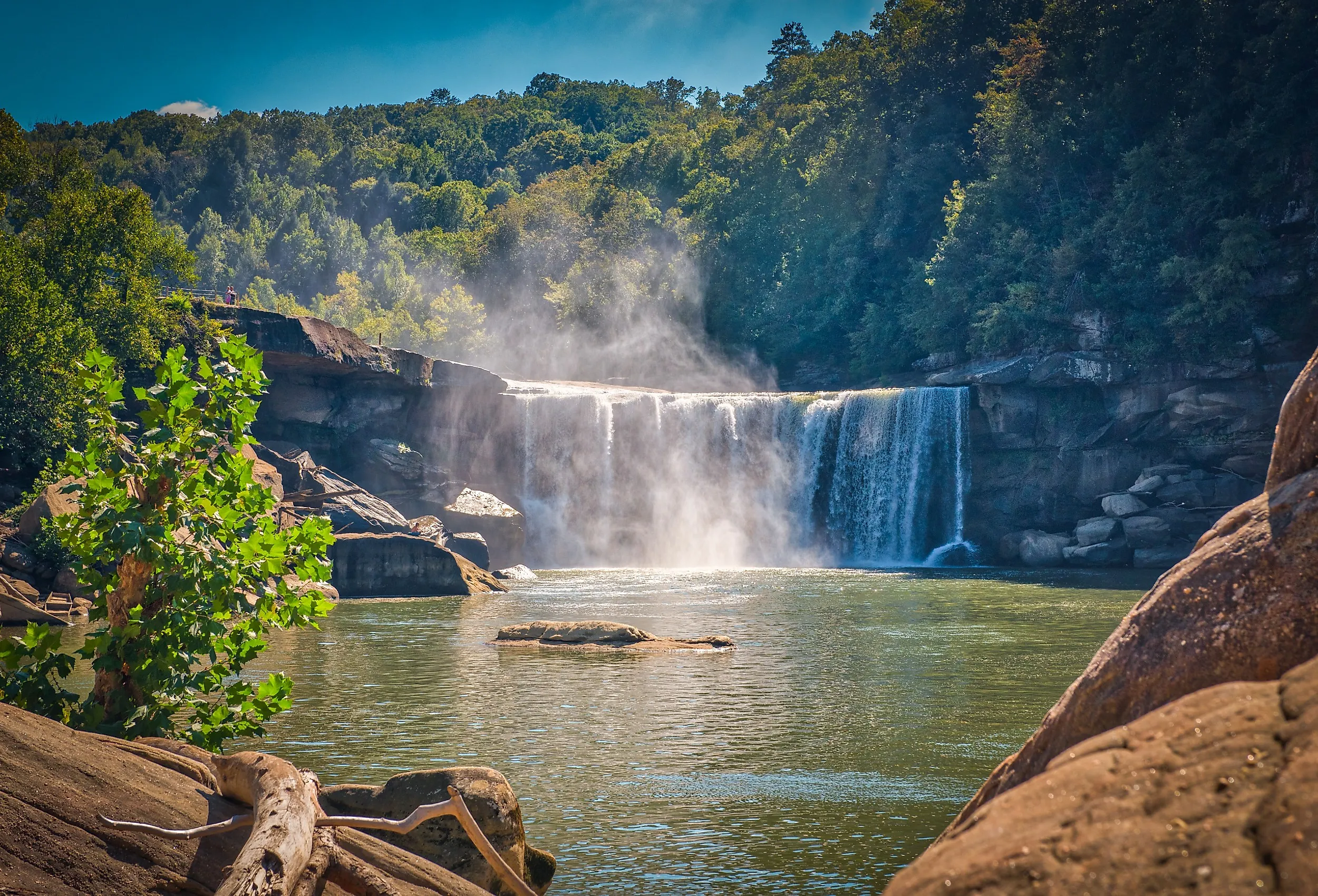
Cumberland Falls drops 68 feet across a 125-foot-wide ledge and is known for the moonbows that can appear near a full moon when skies, spray, and viewing angles align. This optical phenomenon occurs when light from a full moon refracts through the mist generated by the falls. Unlike solar rainbows, moonbows appear white to the naked eye due to the lower light intensity, though long-exposure photography can reveal their spectral colors.
Managed by Kentucky State Parks, the 1,657-acre property functions as a resort park. Facilities include a lodge, a restaurant, and cabins alongside trail access. A dedicated nature preserve of about 1,294 acres sits within the park boundary. The falls are part of the Cumberland River, which cuts through the Cumberland Plateau. The volume changes with river conditions, while moonbow visibility depends on sufficient mist, a bright moon, clear skies, and the correct viewing angle. Park rangers often schedule guided night hikes across the roughly five-night window around each full moon to help visitors locate the optimal viewing angles.
The surrounding forest consists of oak-hickory and pine mixes, typical of the Cumberland Plateau ecosystem. While the falls are the primary attraction, the park maintains about 17 miles of trails, including the 10.8-mile Moonbow Trail, which runs downstream to the mouth of the Laurel River as a section of the Sheltowee Trace. The mist from the falls creates a localized microclimate that supports moisture-loving ferns and mosses on the gorge walls, distinct from the drier upland forests nearby.
Hocking Hills State Park, Ohio

The recess caves of Hocking Hills State Park represent a distinct geological formation within the Appalachian region, carved entirely from Black Hand sandstone. Unlike true limestone caves formed by chemical dissolution, these massive rock shelters result from differential erosion. Water and ice exploit fractures in the soft, porous sandstone to hollow out deep overhangs. Old Man's Cave is one of the park's best-known recess caves, and archaeological evidence shows that Indigenous peoples inhabited the broader Hocking Hills region as early as 7,000 years ago. These shelters sit at the bottom of deep, narrow gorges whose walls rise roughly 150 feet, creating a secluded microclimate significantly cooler than the surrounding plateau. The steep, forested slopes restrict sunlight to the canyon floor for much of the day, fostering dense stands of eastern hemlock and rhododendron that thrive in the shaded, moist environment.
Managed by the Ohio Department of Natural Resources, the 2,356-acre park attracts significant visitation, yet the sheer scale of the gorges provides ample space, with over 10 miles of hiking trails. The sandstone layers here are particularly friable, leading to the formation of narrow slot canyons and waterfalls like Cedar Falls. The geology dictates the hydrology; water percolates through the porous rock, emerging at the base of the cliffs to feed the streams.
Winter conditions often create ice formations within the caves, transforming the shelters into frozen cathedrals. However, this same porosity makes the rock unstable in freeze-thaw cycles, leading to periodic rockfalls. Trail conditions and closures can change, so visitors should check current ODNR alerts before arrival. The ecosystem supports a mix of oak and hickory forests, with hemlock stands thriving in the cooler, shaded gorge bottoms.
Cloudland Canyon State Park, Georgia

The 3,538-acre Cloudland Canyon State Park protects a 1,000-foot-deep gorge cut into the western edge of the Lookout Mountain plateau by the combined waters of Daniel and Bear creeks. Managed by the Georgia Department of Natural Resources, the park has about 64 miles of trails for hikers, mountain bikers, and horseback riders. Elevations range between 800 and 1,980 feet, creating a microclimate that supports hemlock and rhododendron stands more typical of higher latitudes.
The Waterfalls Trail descends over 600 steps and 400 feet to reach the base of Hemlock Falls and Cherokee Falls, where water plunges into deep pools below. The geology features the Pennsylvanian-era sandstone and shale layers that form the canyon walls, with recessed caves and rock shelters dotting the landscape. The canyon's depth creates a temperature inversion, keeping the gorge floor significantly cooler than the surrounding plateau during summer months. This thermal variance supports a diverse array of ferns and mosses that thrive in the constant mist generated by the falls.
Access to the canyon floor requires navigating steep staircases, limiting visitation in certain areas, and preserving the isolation of the lower gorge. The park maintains a network of trails along the rim, offering long views over Lookout Valley and down into Sitton Gulch. The surrounding forest consists of oak-hickory and pine mixes, with dense rhododendron thickets lining the creek beds. Winter conditions often create ice formations on the falls, while spring brings high water volumes that maximize the visual impact of the cascades.
Fall Creek Falls State Park, Tennessee

Fall Creek Falls plunges 256 feet in a single sheer drop, distinguishing it as the highest free-falling waterfall in Tennessee and one of the tallest east of the Mississippi River. This vertical descent exceeds the height of Niagara Falls, though with a significantly lower volume of water. The park covers approximately 29,800 acres on the Cumberland Plateau and offers more than 56 miles of trails connecting multiple waterfalls.
The geology features the plateau edge where the creek erodes the resistant caprock, creating the dramatic drop. Below the falls, a gorge houses a diverse range of microclimates, supporting species typically found at higher latitudes. The park's size allows for extensive backcountry camping, reducing the density of visitors found at the main overlooks. Access to the base of the falls involves a steep descent via a dedicated trail, which can be slippery when wet from the spray.
Fall Creek drains a modest catchment, so the falls can slow to a trickle by late summer and during drought. The park's infrastructure includes a state-operated inn and campgrounds, positioning it as a hub for exploring the Cumberland Plateau. The surrounding forest is a mix of second-growth hardwoods, recovering from logging operations in the early 20th century, now providing dense canopy cover that enhances the acoustic isolation of the gorge.
Ohiopyle State Park, Pennsylvania

The Youghiogheny River drops about 20 feet at Ohiopyle Falls, immediately above the Lower Yough's run of Class III and IV rapids. Managed by the Pennsylvania Department of Conservation and Natural Resources, the 20,500-acre property contains one of the state's premier whitewater destinations. The park maintains about 79 miles of hiking trails plus connections to the Great Allegheny Passage.
The falls occur where the Youghiogheny River cuts through the Pottsville Sandstone, creating a hydraulic feature that recirculates water in a dangerous "keeper" hole at its base. Beyond the main falls, the park protects Cucumber Falls and Sugar Run Falls. Cucumber Falls is a 30-foot cascade in a secluded gorge, reached by a walk of under half a mile round trip. Sugar Run Falls sits at the end of a rugged trail approach. The Youghiogheny carved its gorge by downcutting through uplifted rock, while resistant Pottsville sandstone and conglomerate form the falls, rapids, and cliffs. The park's trail network connects these hydrological features to high-elevation vistas along the Laurel Ridge.
The surrounding forest consists of mixed hardwoods, including oak, hickory, and maple, which provide vibrant autumn foliage. The park's proximity to Pittsburgh makes it a frequent destination for day visitors, yet the extensive acreage allows for solitude on backcountry trails. Winter conditions often freeze the spray of the falls, creating ice formations that attract climbers, while summer months bring high water volumes ideal for rafting and kayaking.
Appalachia's Best State Parks
These eight parks protect roughly 70,000 acres among them and maintain more than 235 miles of trails that reach the region's most significant geological features. Mount Mitchell became a park in 1915 because logging crews had already reached the spruce-fir zone, and the Grayson Highlands balds persist because grazing animals were deliberately returned to them. State management also places these sites outside the federal entrance system, though Ohiopyle and Hocking Hills draw visitation heavy enough to fill popular trailheads early on summer weekends.