Hanalei River, Hawaii
Hanalei River is a 26.5 km long river that flows in the Hawaiian Island of Kaua'i, emptying into the Pacific Ocean via Hanalei Bay. Canoeing, kayaking, and other paddle sports are popular activities on the river, which flows through a spectacular mountainous and forested landscape. The area around the river's mouth, a horseshoe-shaped bay at the Pacific Ocean, is home to about two miles of beaches, and other tourist-related facilities. Hanalei is the second-largest river in the state in terms of its water flow. On July 30, 1998, US President Bill Clinton designated the Hanalei as an American Heritage River.
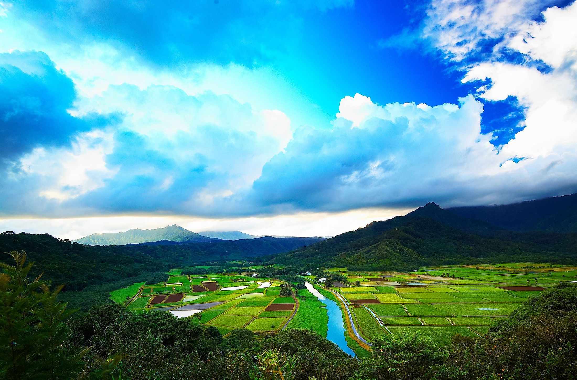
Course Of The Hanalei River

The Hanalei River flows northwards from its source on the eastern slopes of Mount Waiʻaleʻale, a shield volcano and the second-highest peak on Kaua'i Island. It flows through the mountain range that includes the peaks of Namolokama, Mamalahoa, and Hihimanu. The river's course runs 26.5 km until it reaches the Pacific Ocean via Hanalei Bay. The river's mean discharge is 6.12 cubic meters per second, and it drains a watershed of 57 sq. km.

The Hanalei River’s headwaters lie about 1,100 m above sea level, ensuring a fast flow to the upper river. The lower river flows over flatter terrain through the Hanalei National Wildlife Refuge. The river drains into the North Pacific Ocean at the northeastern side of Hanalei Bay as an estuary, at Black Pot Beach Park. The river was named for a communal pot of food that was laid out according to tradition. With a backdrop of mountains and coral reefs along the Hanalei Bay, it has become a well-known and picturesque place for recreation. Swimming is advisable only during the months of June through August. Outside that period, the waters of the Bay are too rough, and the surf is too strong. The lower Hanalei River is subject to a certain extent to the tides, and the river's height can change very quickly and dramatically.
Climate Of Hanalei River Area

As per the Koppen climate classification, the north coast of Kaua'i experiences a humid subtropical climate. Average high temperatures throughout the year range from 25 °C in January to 29 °C from June through September. The slopes of Mount Waiʻaleʻale receive more than 11,430 mm of rain annually, with a rainier season during the winter months, and no distinct dry season.
Due to the heavy rainfalls, flooding is an annual occurrence along some portions of the river, including in the town of Hanalei. In fact, some of the region records the highest rainfalls on the Earth. In 2018, more than 1,270 mm of rain fell within a 24 hour period, causing several flooding conditions. The rising waters damaged many of the agricultural lands adjacent to the river, along with fishponds and other parts of the watershed.
Ecology Of Hanalei River

The island of Kaua'i is volcanic, created by an eruption about five million years ago. The river flows through the Hanalei National Wildlife Refuge before reaching the Ocean. The area has become a favorite spot for birders. The boobie and Layson albatross feed on the saltwater creatures. On shore, there are wandering tattlers, gallinules, and the black-tipped night heron.
The Hanalei River provides an environment for several migrating species, including gobies, crustaceans, and snails, including the Newcomb's snail, a threatened species. The Hanalei Bay forms a part of the Hawaiian Island Humpback Whale National Marine Sanctuary. The river valley represents a unique Hawaiian ecosystem that is home to several endangered species. The Hanalei Bay is renowned for its white sand beaches, and the estuary becomes a nursery for many species of fish. Among the many sea creatures that make the estuary and Bay their home are green sea turtles and spinner dolphins.
Brief History Of Hanalei River

The Hanalei River has a rich history. Several archaeological sites have been found in the river valley dating back thousands of years. The ancient Hawaiians first cultivated taro in the Hanalei Bay wetlands thousands of years ago. According to their legends, it is tied to Polynesians' discovery of the Hawaiian islands in ocean-bound canoes in about 400 CE. The traditional lifestyles of indigenous Hawaiians in the region depended on the river and its course. Captain James Cook reached the Hawaiian Islands, landing on the island of Kaua'i in 1778. Hanalei Pier was constructed in 1892 to promote shipping crops to markets in Asia and elsewhere. Hanalei Valley Road evolved from a trail along the valley around 1885. It became the main route through the region in 1904 and eventually developed into Route 560.

Until the construction of the Hanalei Bridge, a system of wooden ferries pulled by hand was used to cross the river at various points along the valley. Canoes were the other alternative. A one-lane bridge was built across the river at Route 560, near what is now the town of Hanalei, by US Senator Daniel Inouye in 1912. It was replaced in 2003 by concrete construction, although it remains a one-lane road. A tsunami swept through the region in 1957, causing enormous destruction, including the bridge and hundreds of homes in the town. Along with tourism and the Wildlife Refuge, one of the primary land uses in the region is still taro agriculture. The region produces about 60% of Hawaii’s taro crop.


