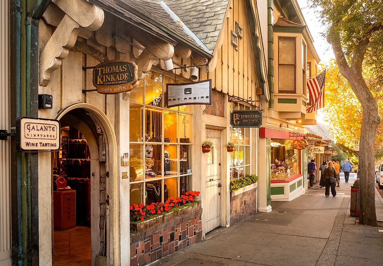
This West Virginia Scenic Byway Is The Road Trip Of A Lifetime
Few places in Appalachia still feel as wild, quiet, and untouched as the highlands of eastern West Virginia. Here, forested ridges stretch for miles, mountain air carries the scent of spruce, and winding roads climb into some of the highest elevations in the state. Cutting right through this landscape is the Highland Scenic Highway, a 43-mile National Scenic Byway made up of West Virginia's Route 39 and Route 150.
The byway running between Marlinton and Richwood is officially designated on the Federal Highway Administration’s “America’s Byways” list. The Highland Scenic Highway is a journey through high elevation forests, sweeping overlooks, alpine meadows, and some of the most pristine wilderness in the eastern United States. Driving it feels less like traveling between towns and more like passing through an entire mountain world.
A Mountain Route Built for Views

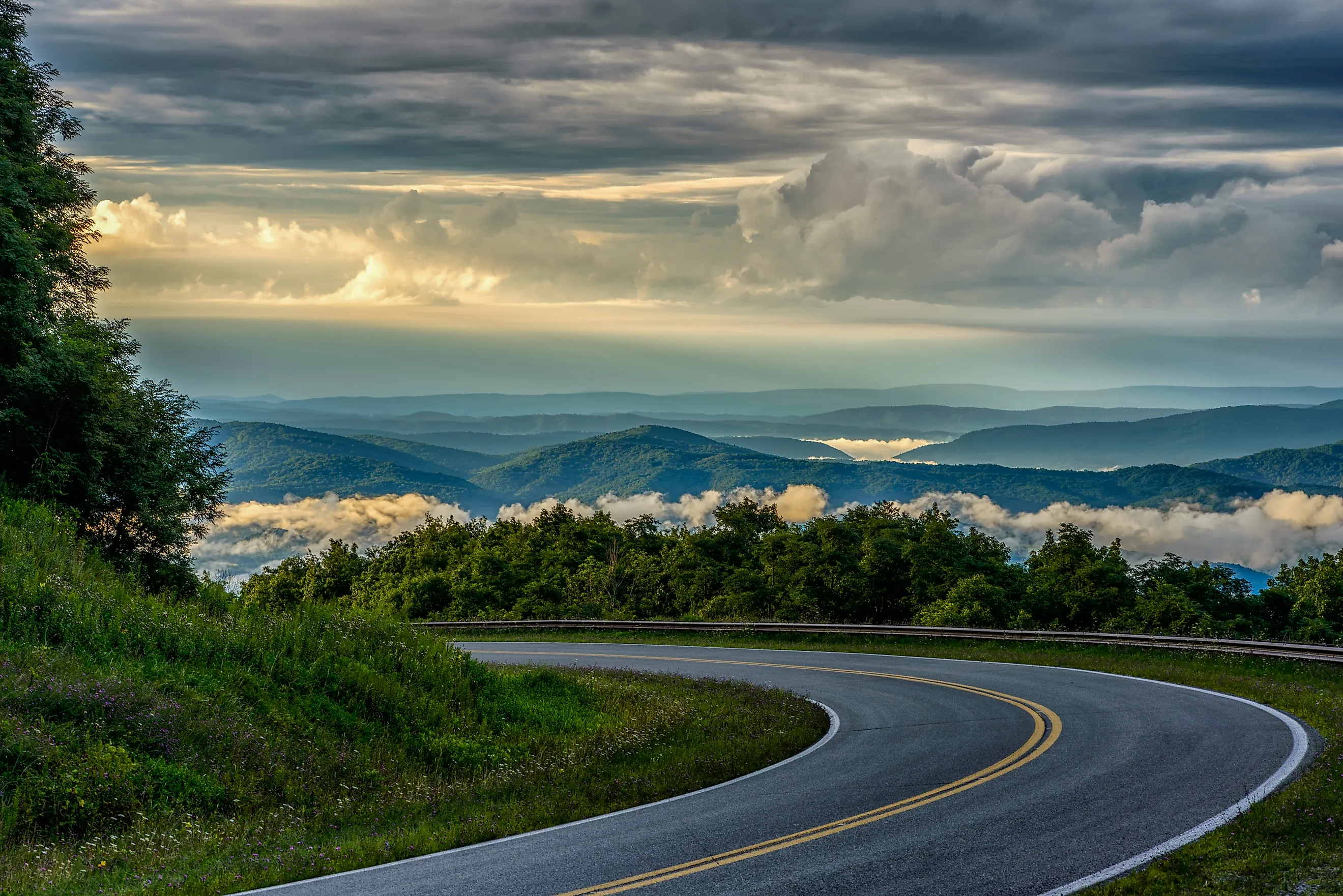
The Highland Scenic Highway was designed to showcase the best of West Virginia’s high country. Traveling along the ridgeline of the Allegheny Mountains, the route stays at elevations between 2,325 feet and 4,500 feet, making it one of the highest and most scenic highways in the state. Unlike many mountain roads that rush through valleys, this one stays on the crest of the landscape.
Along the way, the trees give way to sweeping views periodically across the Monongahela National Forest, where layered ridges rise beyond valleys that extend for miles. Due to its elevation, the Highland Scenic Highway feels different in every season. Spring brings wildflowers and fresh green growth, summer offers cool mountain air and deep forest shade, fall delivers blazing color across every ridgeline, and winter transforms the entire corridor into a snow-covered alpine escape, though there are seasonal closures.
Starting the Drive in Richwood

Visitors can access the byway from both Richwood and Marlinton, but starting at Richwood via Route 39 is often recommended to experience the gradual, dramatic ascent. This approach eases drivers into the landscape, transitioning from river valleys and small-town scenery into dense forest and rising elevations. Once the route reaches the junction with Route 150, the highway enters its most iconic stretch, often referred to as the Highland Scenic Highway proper, which is known for its peak elevations and untouched wilderness.
Forests, Falls, And The Botanical Glades

One of the first major highlights along the route is Falls of Hills Creek, a short detour worth every minute. A well-marked trail and boardwalk system lead through dense forest to three cascading waterfalls that plunge into moss-covered gorges. The roaring water and the scent of wet wood make this stop feel like a hidden mountain sanctuary, and it is a great place to stretch your legs and hear nothing but creek and breeze. Just be cautious during rains as accessing the second and third waterfalls at the creek require navigating several stairs, which can become quite slippery, especially after rainfall.

A little farther along the highland corridor, the terrain begins to flatten into broad woodlands and open bogs, which is rare in Appalachia. Here you will find the Cranberry Glades Botanical Area, one of the largest botanical bogs in the eastern United States. With its boardwalk trails and informative signs, this vivid landscape has everything from peaty glades and carnivorous plants to cranberry bogs spread out against a backdrop of spruce and oak. This kind of wetland is more common in the northern areas of the US and in Canada. It is one of those stops that surprises most visitors, a chance to see uncommon plants and quiet wetlands without leaving the byway.
Climbing Into The Highland Ridge

After the falls and the glades, the drive continues upward onto Route 150, the high-country section that most people picture when they think of the Highland Scenic Highway. At over 4,500 feet in places, this ridgetop road feels cooler and quieter than the valleys below. Spruce forests line the highway as fog drifts across the pavement and views begin to widen.
Frequent scenic pull-offs make it easy to stop, step out, and take in the views. Big Spruce Overlook and Red Lick Overlook are two of the most breathtaking overlook points out of four in the highway, each offering panoramic looks across forested ridges that seem to stretch for miles. Whether the sun is shining or it is overcast, each overlook tells a different part of the same story.
Seasonal Changes And Wildlife Along The Way

The Highland Scenic Highway is shaped as much by its seasons as by its curves. Summer covers the forest in deep green and brings cool, refreshing air to the high ridges. Early fall is a favorite time for many travelers, when foliage lights up in reds and oranges that seem almost too stunning for the mountains. Winter closures are typical once snow and ice accumulate, as the high-elevation sections, especially Route 150, are not maintained for winter travel. Along the roadside and in the woods beyond, wildlife like white-tailed deer, wild turkeys, bears, red foxes, and songbirds can be spotted during quiet parts of the day.
Descending Toward Marlinton

As you descend from the high ridges, the road winds through hardwood forests and rolling hills before opening into expansive valleys. Whether you head south toward Marlinton or return to Richwood, the views of endless layers of timbered peaks and wildflower-strewn glades stay with you. Even as the elevation drops, the drive eases you back toward town after miles of open mountain scenery.
When To Plan Your Drive

Due to its high elevation, the Highland Scenic Highway (Route 150) is not open year-round. Heavy snowfall and harsh winter conditions typically force the road to close from late fall through early spring, usually reopening around May depending on weather. The best time to drive is late spring through October, with September and October being especially popular thanks to the region’s brilliant fall foliage.
Summer offers cool temperatures and lush greenery, while late spring brings wildflowers and rushing streams from snowmelt. Bear in mind that there are no gas stations or restaurants along the 43-mile stretch of the highway, so it is essential to fill up on gas and pack food/ supplies in nearby towns like Richwood or Marlinton before starting your trip.
Why This Scenic Byway Lives Up To Its Name

The Highland Scenic Highway is not meant for rushing from one place to another. Its 43-mile stretch of Route 39 and Route 150 is designed for scenic overlooks, short hikes, and stops at places like Falls of Hills Creek and the Cranberry Glades Botanical Area.

With elevations topping 4,500 feet and long sections that cut through Monongahela National Forest, the drive offers a rare chance to experience West Virginia’s high country at a slower pace. Even after the road descends back toward the valleys, the cool mountain air and wide Appalachian views tend to linger long after the trip ends, making it one of the most memorable scenic byway drives in West Virginia.