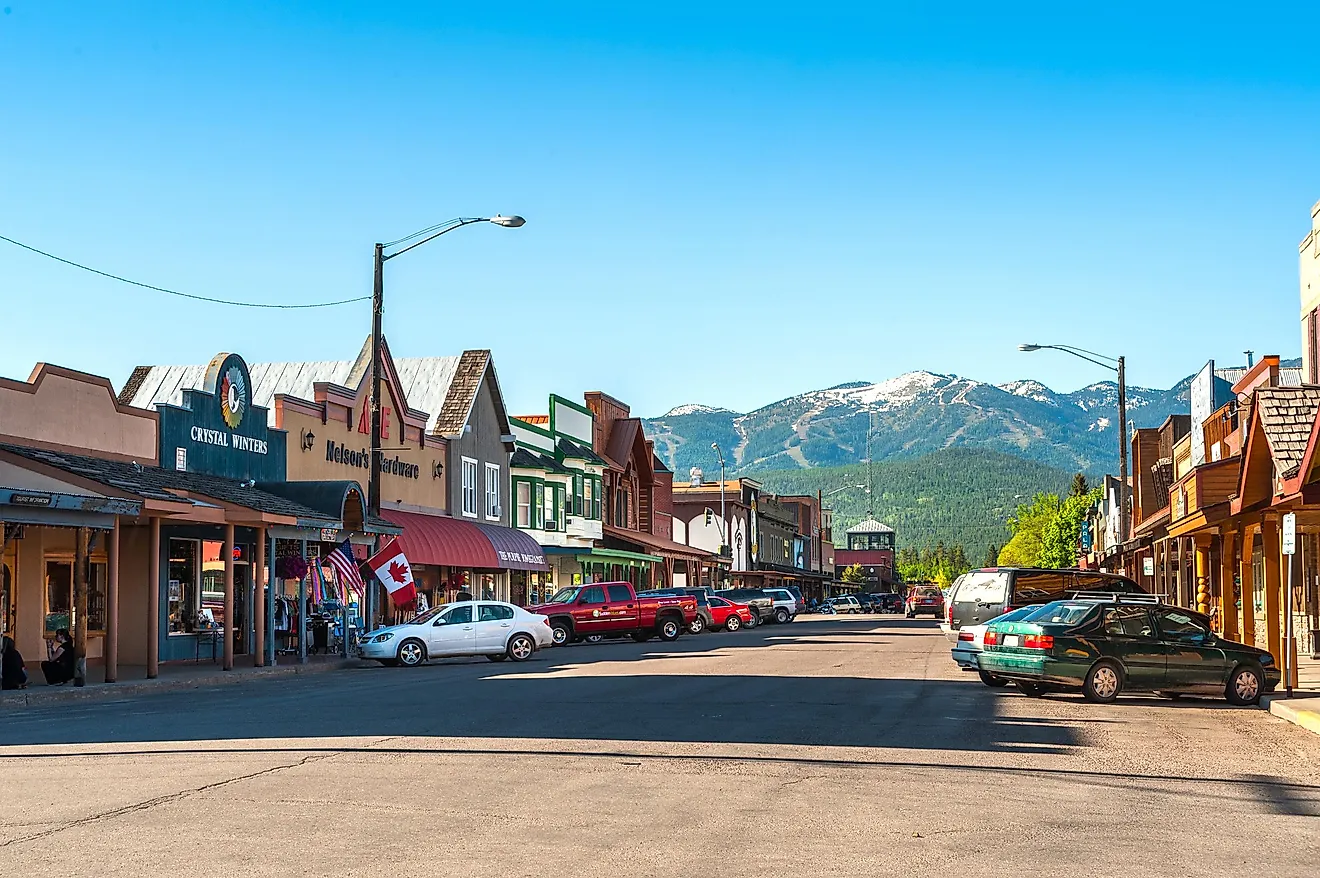
7 Most Scenic Drives in Wyoming
Wyoming is hard to beat for road trips, with drives that pass through Wind River Canyon and up to Beartooth Pass at 10,947 feet. Two All-American Roads and 21 State Scenic and Forest Service Byways help mark out some of the state’s most rewarding routes. Sorted by length from shortest to longest, this list compiles the drives along Scenic Byways with superlative scenery, with attention paid to the state's varied topography, particularly among ecoregions such as the Black Hills, Wyoming Basin, and Middle and Southern Rockies.
Wind River Canyon Scenic Byway

Running for 34 miles along US 20 between Shoshoni and Thermopolis, this particularly scenic stretch of highway through the titular canyon has been popular with Yellowstone-bound motorists for over a century. Heading north from the historic ranching community of Shoshoni, there are excellent views of Boysen State Park and Boysen Reservoir to the right, with the Owl Creek Mountains far off in the distance. The scenery changes dramatically after the road passes Boysen Dam and into the Wind River Canyon itself. For the next roughly 13 miles, you are surrounded on either side by sheer rock walls over 2,500 feet high, with some of the rock formations dating all the way back to the Precambrian period.
Passing through unsealed rock tunnels and alongside white water rapids, drivers are advised to be on the lookout for the roughly 100 resident bighorn sheep, who were reintroduced to the canyon in the 1990s. Upon leaving the canyon, the road crosses the river at the "Wedding of the Waters," whereupon its name changes to the Bighorn River as you climb into the Bighorn Basin. The Scenic Byway comes to an end in the old spa town of Thermopolis, home of Hot Springs State Park and the Wyoming Dinosaur Center.
Black Hills Scenic Byway

When one mentions the Black Hills, it's hard not to think of South Dakota first and foremost, but what many travelers don't realize is that Wyoming has its own share of thrilling mountain driving through this storied range, with the Black Hills Scenic Byway stretching for 45 miles along US 85 and WYO 585 between Newcastle and Sundance. It should be noted that the officially designated byway also includes the stretch of US 85 leading to the South Dakota border, but for the sake of continuity, we will focus exclusively on the Newcastle—Sundance section. Heading north along US 85 from the coal-mining town of Newcastle, the road gradually climbs into the foothills of the Black Hills, with highlights including a scenic overlook over the Salt Creek Valley and the historic Cambria Casino resort.
After 17 miles, drivers will reach the tiny hamlet of Four Corners on the Canyon Springs Prairie and turn northwest onto WYO 585. For the next 27 miles, the road runs through sparsely inhabited ranchland, with the encroaching Black Hills on the right and the ever-expanding vista over the Powder River Basin on the left. Travelers can also catch a glimpse of Inyan Kara Mountain, a sacred landmark to the Lakota people. The Byway terminates at the classic Western town of Sundance, the place that gave legendary outlaw Harry "The Sundance Kid" Longabaugh his nickname. Sundance is also the gateway to other regional attractions, like Devil's Tower.
Bighorn Scenic Byway

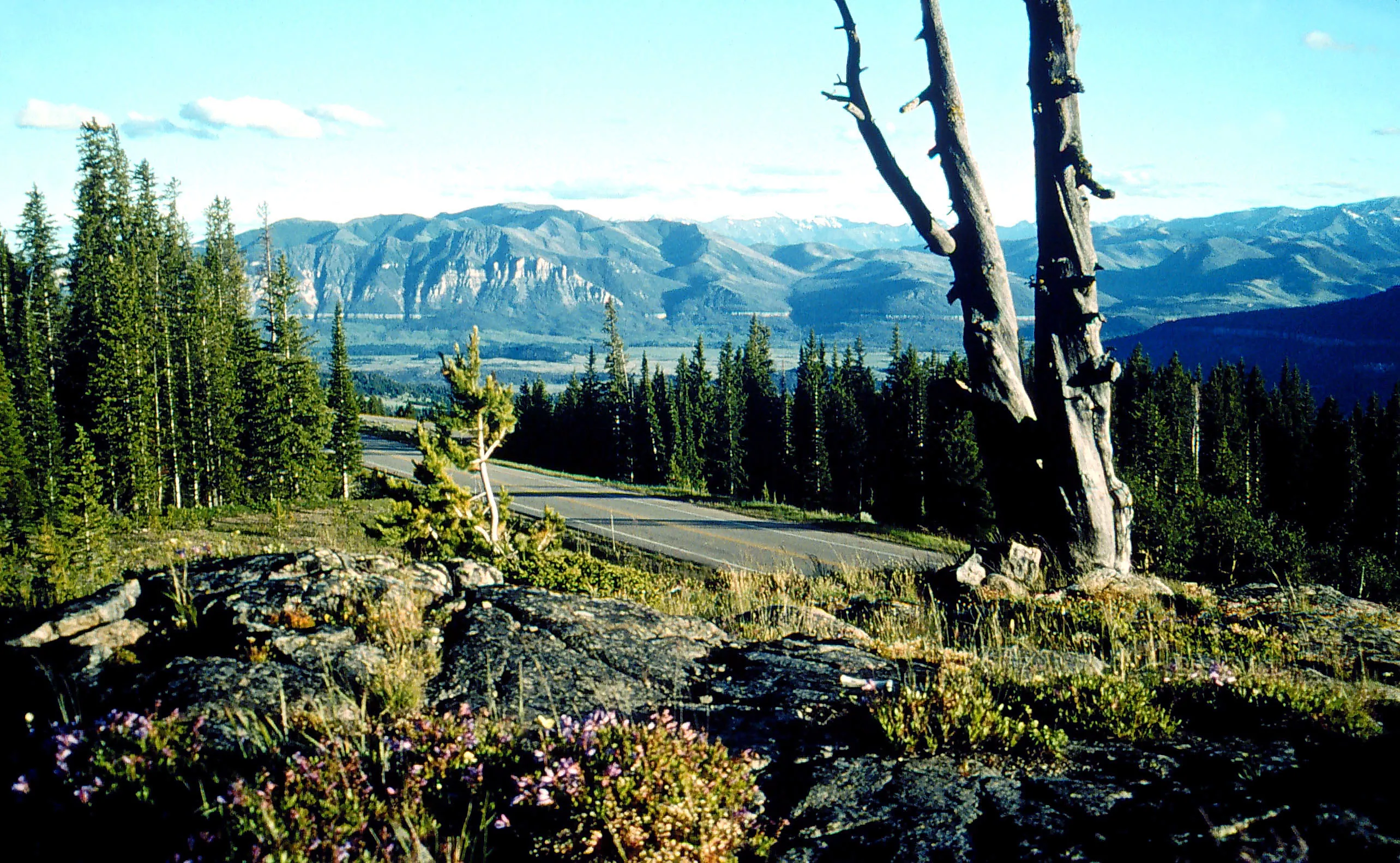
Right in the middle of the state's northern border, a seemingly islanded section of the Middle Rockies known as the Bighorn Mountains rises from the plains and into the clouds, and the Bighorn Scenic Byway runs for 58 miles along US 14 right through the heart of it. Heading east on US 14 from the tiny community of Shell, the dramatic scenery begins in short order as the road winds its way through Shell Canyon and past the spectacular Shell Falls. Entering Bighorn National Forest, the road continues to climb through thick pine forests and stunning alpine scenery up to the road's summit at Granite Pass at 9,033 feet.
Ten miles later at Burgess Junction, the road takes a hard right and passes the man-made Sibley Lake, with much of the road perched atop high limestone cliffs. On the right, drivers can catch a glimpse of the so-called "Fallen City," a massive field of huge limestone boulders along a hillside resembling the ruins of a lost civilization. Eventually, the road begins its long, winding exit from the mountains, with pull-offs at the Sand Turn and Hogback Interpretive Sites offering visitors an incredible panorama of the vast ocean of green that is the Powder River Basin. The byway finally concludes just shy of the modest hamlet of Dayton, the nearest settlement to the infamous Tongue River Cave.
Beartooth Scenic Highway

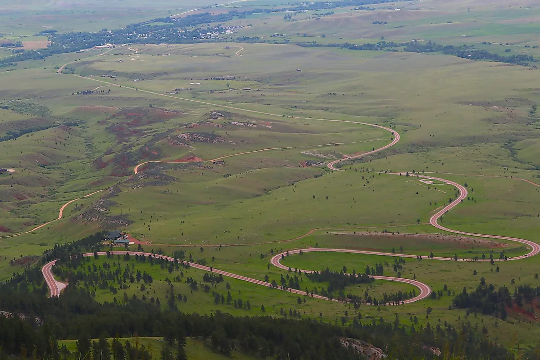
It may be cheating slightly by including the Beartooth Scenic Highway in a list of famous Wyoming roads, as this All-American Road actually both starts and ends in Montana, but the majority of the road's 68-mile route passes through Wyoming. This iconic highway passes through the Absaroka-Beartooth Wilderness, once described by journalist Charles Kuralt as "the most beautiful drive in America." Starting in the town of Red Lodge, Montana, where visitors can find the Yellowstone Wildlife Sanctuary, the road heads southwest along US 212, initially paralleling Rock Creek, before making the steep climb into the Beartooth Mountains on a harrowing series of switchbacks, culminating at the jaw-dropping Vista Point Observation Site. Just four miles down the road, travelers will cross the Wyoming state line and enter the Shoshone National Forest. The road continues across the barren, perennially snowy landscape of the Beartooth Plateau, past the summer-only Beartooth Basin Ski Area and up to the summit of Beartooth Pass at 10,947 feet.
Past the summit, the road rambles along a panorama of forests and lakes for the next several miles, passing the famous Top of the World Store on the right and reaching Beartooth Lake shortly thereafter, before reaching the Pilot Index Overlook. The road parallels Clark's Fork River before re-entering Montana in the shadow of Index and Pilot Peaks. The Beartooth Scenic Highway terminates just west of Cooke City at the Northeast Entrance Station for Yellowstone National Park. The entire highway is closed from Indigenous Peoples' Day to Memorial Day, and motorists should be warned that inclement weather can strike at any time of the year, but those who come prepared will bear witness to some of the most breathtaking scenery to be found anywhere in the continental US.
Star Valley Scenic Byway

The Star Valley Scenic Byway consists of a single 80-mile stretch of US 89 leading from the Idaho state line to the start of Teton County in the Bridger-Teton National Forest. Crossing into Wyoming about three miles north of the town of Geneva, the road begins a steady climb into Salt Canyon and up to the summit at Salt River Pass, which features a scenic overlook. From there, the road descends into Star Valley proper, menaced by the towering Wyoming Range on the right, through various small towns such as Smoot, Afton (home of the World's Largest Elkhorn Arch), Thayne, and Alpine, which provides convenient access to the Palisades Reservoir.
After crossing the Snake River, US 89 joins US 26 and turns sharply right to follow the river into the mountains, climbing into the Snake River Canyon and passing many campgrounds and trailheads. The Scenic Byway technically ends at the Lincoln-Teton County line, but the highway continues north through the canyon and into the valley of Jackson Hole, home to the major resort town of Jackson and gateway to Grand Teton National Park.
Flaming Gorge-Green River Basin Scenic Byway

The other All-American Road on this list also includes a brief out-of-state section, this time through Utah, but it comprises only about 47 miles out of a total of 142. Blazing a trail through the high desert of the Wyoming Basin, the journey begins in the historic mining town of Rock Springs, home of the Rock Springs Historical Museum and the historic Outlaw Inn. From there, you'll head west along Interstate 80 to the exit for US 191, where the Scenic Byway officially begins. Turning due south, there will be vast stretches of desert to the left and a range of mesas to the right. Continue on to Minnie's Gap, where you'll find the Flaming Gorge-Uintas National Scenic Byway for the time being. Continue winding your way south to the town of Dutch John and cross over the Green River at the Flaming Gorge Dam, with the Flaming Gorge Dam Visitor Center just to the right.
In Greendale, you'll leave US 191 and turn right onto Utah State Route 44. Shortly afterwards lies the Greendale Overlook Interpretive Site to the right; from here, the highway continues along the southern border of the Flaming Gorge National Recreation Area through thick pine and aspen forests before reaching the dizzying zigzags down the mountainside towards Sheep Creek, a better view of which can be attained from the Sheep Creek Overlook. Head due north through the high desert up WYO 530, better known as West Flaming Gorge Road, which affords drivers a panoramic view of the sparkling waters of Flaming Gorge Reservoir to the right for the next several dozen miles. Eventually, the reservoir gives way to vast and empty plains before reaching the final destination at the old railroad town of Green River, home of Expedition Island and the Sweetwater County Museum.
Wyoming Centennial Scenic Byway

The longest singular Scenic Byway in the state, the Wyoming Centennial Scenic Byway runs for 163 miles along a horseshoe-shaped route across a wide range of local topography, starting and ending at the edge of the Wyoming Basin. Starting in the quintessential cowboy town of Pinedale, gateway to the Wind River Range, you'll head northwest along US 191, following the course of the Green and Hoback Rivers into the Bridger-Teton National Forest with the high peaks of the Gros Ventre Range in the distance. Continue into the mountains, past the tiny hamlet of Bondurant, and into the Hoback River Canyon. At Hoback Junction, turn right to head north along the combined US 26/89/191 towards Jackson, the same section of road covered under the Star Valley Scenic Byway entry. After Jackson, continue north parallel to the Snake River, passing the National Museum of Wildlife Art and Jackson National Fish Hatchery and entering Grand Teton National Park.
Pressing on northwards, the high plains give way to pine forests once you pass the Snake River Overlook. You'll soon reach Moran Junction, where US 191 continues due north into Grand Teton National Park, while continuing onto US 26 and veering to the east. The road climbs into the high Togwotee Pass over the Continental Divide, with the high cliffs of the Absaroka Range welcoming you to the Shoshone National Forest. You'll descend sharply out of the mountains, past the highly popular Falls Campground, before the forest gives way once more to the plains of the Wyoming Basin as you pass the Tie Hack Monument on the right. After joining up with the Wind River, you'll find yourself at the end of the odyssey in the bucolic ranching community and artist colony of Dubois, home of the Dubois Museum, the National Bighorn Sheep Interpretive Center, and the National Museum of Military Vehicles.
Get Lost In Beautiful Wyoming
Truth be told, there is a very valid reason that the roads mentioned in this article are often swarming with tourists during the summer months; the bevy of natural attractions scattered throughout the state is no secret, and some of America's most coveted bucket-list destinations can be found along these winding country lanes and dusty trails.
Wyoming is in many ways a microcosm of the entire American West, and one could spend the better part of their lifetime exploring the state's miles upon miles upon miles of highways and byways through desolate ranchland, across verdant forests, past humble villages, up the sides of mountains and down into steep gorges, in a cyclorama of big skies and virgin lands that seems to go on forever no matter which direction you turn.