Where is McLennan County, Texas?
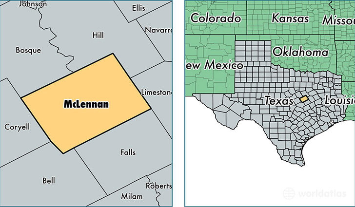
McLennan County is a county equivalent area found in Texas, USA. The county government of McLennan is found in the county seat of Waco.
With a total 2,745.99 sq. km of land and water area, McLennan County, Texas is the 705th largest county equivalent area in the United States. Home to 243,441 people, McLennan County has a total 96449 households earning 41922 on average per year.
McLennan County, Texas offers the following attraction to visitors: Waco Mammoth National Monument
McLennan County, Texas - Quick Facts
| FIPS Code | 48309 |
| Area Codes | 254 |
| Time Zone | CST |
| Major Cities | Waco (population: 151,170), Woodway (population: 23,886), Hewitt (population: 13,773), McGregor (population: 9,458), Lorena (population: 7,939), West (population: 6,557), Moody (population: 5,307), China Spring (population: 5,043), Mart (population: 3,566), Elm Mott (population: 3,053) |
| Land Area | 93,993 sq miles |
| Water Area | 1,037 sq miles |
| Household Income | $41,922 |
| Housing Units | 96,449 |
| Median Home Value | $108,300 |
| High School Grads | 82% of population |
| Holders of Bachelors Degrees | 22% of population |
| Retail Spending | $12,892 per capita |
| Food & Accomodation Sales | $375,262 per capita |
This page was last updated on June 30, 2016.