Where is Galveston County, Texas?
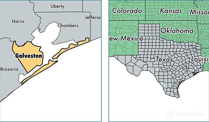
Galveston County is a county equivalent area found in Texas, USA. The county government of Galveston is found in the county seat of Galveston.
With a total 2,263.12 sq. km of land and water area, Galveston County, Texas is the 1032nd largest county equivalent area in the United States. Home to 314,198 people, Galveston County has a total 137392 households earning 61877 on average per year.
Galveston County, Texas offers the following attraction to visitors: USS Stewart (DE-238)
Galveston County, Texas - Quick Facts
| FIPS Code | 48167 |
| Area Codes | 409,281 |
| Time Zone | CST |
| Major Cities | League City (population: 73,834), Galveston (population: 51,921), Friendswood (population: 49,311), Texas City (population: 44,874), Dickinson (population: 40,028), Santa Fe (population: 19,645), La Marque (population: 14,758), Hitchcock (population: 9,389), Bacliff (population: 8,946), Kemah (population: 5,972) |
| Land Area | 121,312 sq miles |
| Water Area | 379 sq miles |
| Household Income | $61,877 |
| Housing Units | 137,392 |
| Median Home Value | $148,600 |
| High School Grads | 87% of population |
| Holders of Bachelors Degrees | 29% of population |
| Retail Spending | $9,700 per capita |
| Food & Accomodation Sales | $590,991 per capita |
| Universities and Colleges | Galveston College, Texas A & M University at Galveston |
This page was last updated on June 30, 2016.