Where is Haywood County, Tennessee?
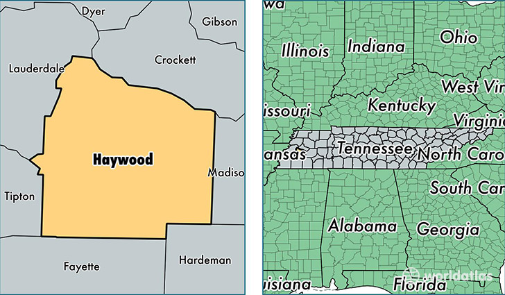
Haywood County is a county equivalent area found in Tennessee, USA. The county government of Haywood is found in the county seat of Brownsville.
With a total 1,383.21 sq. km of land and water area, Haywood County, Tennessee is the 2060th largest county equivalent area in the United States. Home to 18,185 people, Haywood County has a total 8373 households earning 34542 on average per year.
Haywood County, Tennessee - Quick Facts
| FIPS Code | 47075 |
| Area Codes | 731 |
| Time Zone | CST |
| Major Cities | Brownsville (population: 14,150), Stanton (population: 2,321) |
| Land Area | 7,021 sq miles |
| Water Area | 533 sq miles |
| Household Income | $34,542 |
| Housing Units | 8,373 |
| Median Home Value | $94,500 |
| High School Grads | 76% of population |
| Holders of Bachelors Degrees | 11% of population |
| Retail Spending | $9,425 per capita |
| Food & Accomodation Sales | $13,900 per capita |
This page was last updated on June 30, 2016.