Where is Decatur County, Tennessee?
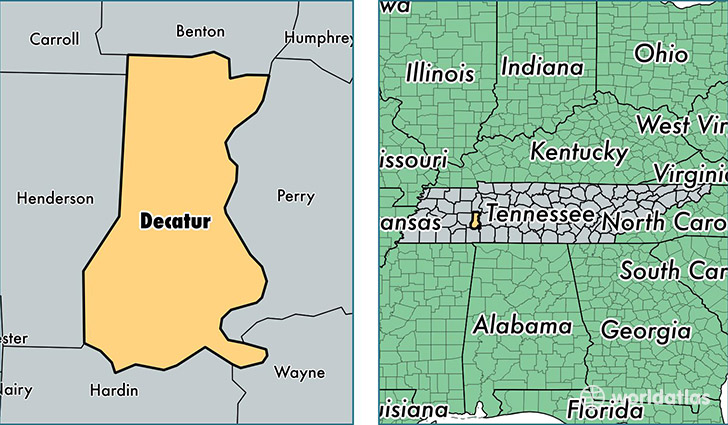
Decatur County is a county equivalent area found in Tennessee, USA. The county government of Decatur is found in the county seat of Decaturville.
With a total 893.24 sq. km of land and water area, Decatur County, Tennessee is the 2746th largest county equivalent area in the United States. Home to 11,666 people, Decatur County has a total 6804 households earning 36258 on average per year.
Decatur County, Tennessee - Quick Facts
| FIPS Code | 47039 |
| Area Codes | 731 |
| Time Zone | CST |
| Major Cities | Parsons (population: 6,054), Decaturville (population: 3,198), Scotts Hill (population: 2,056), Bath Springs (population: 780), Sugar Tree (population: 569) |
| Land Area | 4,504 sq miles |
| Water Area | 334 sq miles |
| Household Income | $36,258 |
| Housing Units | 6,804 |
| Median Home Value | $83,100 |
| High School Grads | 79% of population |
| Holders of Bachelors Degrees | 14% of population |
| Retail Spending | $8,594 per capita |
| Food & Accomodation Sales | $6,048 per capita |
This page was last updated on June 30, 2016.