Where is Carroll County, Tennessee?
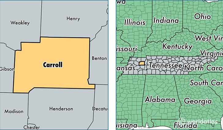
Carroll County is a county equivalent area found in Tennessee, USA. The county government of Carroll is found in the county seat of Huntingdon.
With a total 1,554.23 sq. km of land and water area, Carroll County, Tennessee is the 1742nd largest county equivalent area in the United States. Home to 28,370 people, Carroll County has a total 13118 households earning 35049 on average per year.
Carroll County, Tennessee - Quick Facts
| FIPS Code | 47017 |
| Area Codes | 731 |
| Time Zone | CST |
| Major Cities | McKenzie (population: 10,046), Huntingdon (population: 8,643), Bruceton (population: 2,525), Cedar Grove (population: 2,432), Atwood (population: 1,840), Trezevant (population: 1,493), Hollow Rock (population: 1,431), Lavinia (population: 1,032), Yuma (population: 904), Buena Vista (population: 473) |
| Land Area | 10,954 sq miles |
| Water Area | 599 sq miles |
| Household Income | $35,049 |
| Housing Units | 13,118 |
| Median Home Value | $80,500 |
| High School Grads | 79% of population |
| Holders of Bachelors Degrees | 15% of population |
| Retail Spending | $6,564 per capita |
| Food & Accomodation Sales | $15,356 per capita |
This page was last updated on June 30, 2016.