Where is Colleton County, South Carolina?
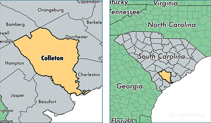
Colleton County is a county equivalent area found in South Carolina, USA. The county government of Colleton is found in the county seat of Walterboro.
With a total 2,935.2 sq. km of land and water area, Colleton County, South Carolina is the 639th largest county equivalent area in the United States. Home to 37,771 people, Colleton County has a total 19586 households earning 33233 on average per year.
Colleton County, South Carolina - Quick Facts
| FIPS Code | 45029 |
| Area Codes | 843 |
| Time Zone | EST |
| Major Cities | Walterboro (population: 21,797), Yemassee (population: 4,848), Cottageville (population: 4,043), Ruffin (population: 2,819), Edisto Island (population: 2,478), Round O (population: 2,134), Smoaks (population: 1,807), Green Pond (population: 1,116), Islandton (population: 1,113), Lodge (population: 561) |
| Land Area | 14,583 sq miles |
| Water Area | 1,056 sq miles |
| Household Income | $33,233 |
| Housing Units | 19,586 |
| Median Home Value | $89,900 |
| High School Grads | 79% of population |
| Holders of Bachelors Degrees | 15% of population |
| Retail Spending | $10,721 per capita |
| Food & Accomodation Sales | $55,994 per capita |
This page was last updated on June 30, 2016.