Where is Malheur County, Oregon?
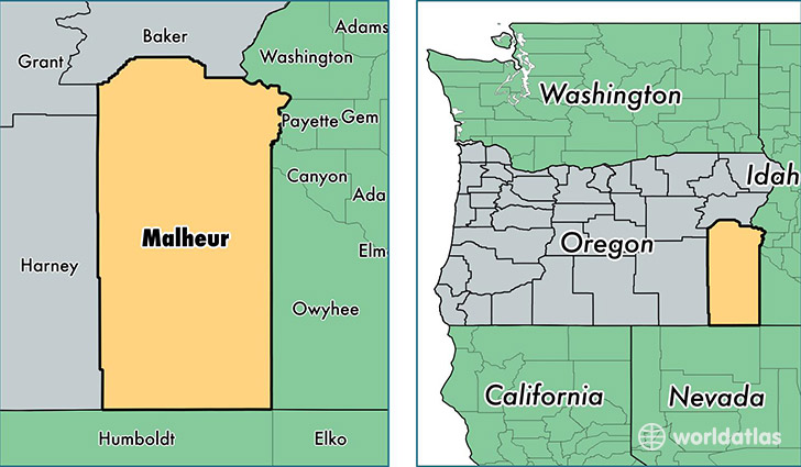
Malheur County is a county equivalent area found in Oregon, USA. The county government of Malheur is found in the county seat of Vale.
With a total 25,717.7 sq. km of land and water area, Malheur County, Oregon is the 29th largest county equivalent area in the United States. Home to 30,359 people, Malheur County has a total 11561 households earning 35578 on average per year.
Malheur County, Oregon - Quick Facts
| FIPS Code | 41045 |
| Area Codes | 541 |
| Time Zone | MST |
| Major Cities | Ontario (population: 18,786), Nyssa (population: 5,410), Vale (population: 4,438), Adrian (population: 676), Jordan Valley (population: 627), Huntington (population: 551), Harper (population: 243), Brogan (population: 106), Juntura (population: 106), Westfall (population: 58) |
| Land Area | 11,722 sq miles |
| Water Area | 9,887 sq miles |
| Household Income | $35,578 |
| Housing Units | 11,561 |
| Median Home Value | $132,600 |
| High School Grads | 80% of population |
| Holders of Bachelors Degrees | 13% of population |
| Retail Spending | $15,637 per capita |
| Food & Accomodation Sales | $45,264 per capita |
This page was last updated on June 30, 2016.