Where is Choctaw County, Oklahoma?
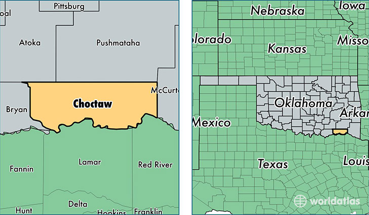
Choctaw County is a county equivalent area found in Oklahoma, USA. The county government of Choctaw is found in the county seat of Hugo.
With a total 2,070.88 sq. km of land and water area, Choctaw County, Oklahoma is the 1181st largest county equivalent area in the United States. Home to 15,161 people, Choctaw County has a total 7499 households earning 30201 on average per year.
Choctaw County, Oklahoma - Quick Facts
| FIPS Code | 40023 |
| Area Codes | 580 |
| Time Zone | CST |
| Major Cities | Hugo (population: 8,524), Boswell (population: 2,034), Fort Towson (population: 1,537), Soper (population: 1,355), Sawyer (population: 868), Grant (population: 559), Swink (population: 69) |
| Land Area | 5,854 sq miles |
| Water Area | 770 sq miles |
| Household Income | $30,201 |
| Housing Units | 7,499 |
| Median Home Value | $71,600 |
| High School Grads | 81% of population |
| Holders of Bachelors Degrees | 14% of population |
| Retail Spending | $7,928 per capita |
| Food & Accomodation Sales | $10,906 per capita |
This page was last updated on June 30, 2016.