Where is Butler County, Ohio?
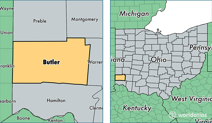
Butler County is a county equivalent area found in Ohio, USA. The county government of Butler is found in the county seat of Hamilton.
With a total 1,217.36 sq. km of land and water area, Butler County, Ohio is the 2283rd largest county equivalent area in the United States. Home to 374,158 people, Butler County has a total 148555 households earning 56610 on average per year.
Butler County, Ohio - Quick Facts
| FIPS Code | 39017 |
| Area Codes | 513 |
| Time Zone | EST |
| Major Cities | Hamilton (population: 135,224), Middletown (population: 79,827), West Chester (population: 49,387), Fairfield (population: 44,210), Oxford (population: 27,218), Trenton (population: 13,990), Monroe (population: 8,606), Okeana (population: 3,442), Somerville (population: 2,855), Seven Mile (population: 692) |
| Land Area | 144,463 sq miles |
| Water Area | 467 sq miles |
| Household Income | $56,610 |
| Housing Units | 148,555 |
| Median Home Value | $157,400 |
| High School Grads | 89% of population |
| Holders of Bachelors Degrees | 27% of population |
| Retail Spending | $13,616 per capita |
| Food & Accomodation Sales | $531,073 per capita |
| Universities and Colleges | Miami University-Middletown |
This page was last updated on June 30, 2016.