Where is Rockland County, New York?
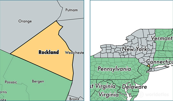
Rockland County is a county equivalent area found in New York, USA. The county government of Rockland is found in the county seat of New City.
With a total 516.29 sq. km of land and water area, Rockland County, New York is the 3021st largest county equivalent area in the United States. Home to 323,866 people, Rockland County has a total 104138 households earning 84951 on average per year.
Rockland County, New York - Quick Facts
| FIPS Code | 36087 |
| Area Codes | 845 |
| Time Zone | EST |
| Major Cities | Spring Valley (population: 60,197), Monsey (population: 39,674), New City (population: 32,134), Suffern (population: 23,921), Nanuet (population: 23,493), Nyack (population: 15,386), Pearl River (population: 15,079), Stony Point (population: 13,643), Haverstraw (population: 12,141), Pomona (population: 10,187) |
| Land Area | 125,045 sq miles |
| Water Area | 173 sq miles |
| Household Income | $84,951 |
| Housing Units | 104,138 |
| Median Home Value | $435,300 |
| High School Grads | 88% of population |
| Holders of Bachelors Degrees | 40% of population |
| Retail Spending | $13,019 per capita |
| Food & Accomodation Sales | $435,305 per capita |
| Universities and Colleges | Capri School of Hair Design, Nyack College, Saint Thomas Aquinas College |
This page was last updated on June 30, 2016.