Where is Wilson County, North Carolina?
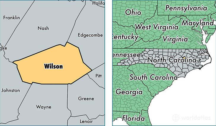
Wilson County is a county equivalent area found in North Carolina, USA. The county government of Wilson is found in the county seat of Wilson.
With a total 967.96 sq. km of land and water area, Wilson County, North Carolina is the 2680th largest county equivalent area in the United States. Home to 81,401 people, Wilson County has a total 35514 households earning 39204 on average per year.
Wilson County, North Carolina - Quick Facts
| FIPS Code | 37195 |
| Area Codes | 252,919 |
| Time Zone | EST |
| Major Cities | Wilson (population: 60,313), Elm City (population: 8,182), Lucama (population: 5,309), Stantonsburg (population: 3,591), Sims (population: 3,328), Macclesfield (population: 2,955), Walstonburg (population: 2,571), Fountain (population: 1,963), Black Creek (population: 752), Saratoga (population: 400) |
| Land Area | 31,429 sq miles |
| Water Area | 368 sq miles |
| Household Income | $39,204 |
| Housing Units | 35,514 |
| Median Home Value | $111,500 |
| High School Grads | 79% of population |
| Holders of Bachelors Degrees | 18% of population |
| Retail Spending | $13,816 per capita |
| Food & Accomodation Sales | $112,816 per capita |
| Universities and Colleges | Barton College, Mitchells Hairstyling Academy |
This page was last updated on June 30, 2016.