Where is Cherokee County, North Carolina?
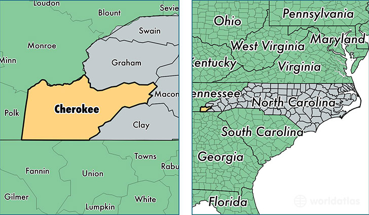
Cherokee County is a county equivalent area found in North Carolina, USA. The county government of Cherokee is found in the county seat of Murphy.
With a total 1,208.8 sq. km of land and water area, Cherokee County, North Carolina is the 2296th largest county equivalent area in the United States. Home to 27,141 people, Cherokee County has a total 17563 households earning 34432 on average per year.
Cherokee County, North Carolina - Quick Facts
| FIPS Code | 37039 |
| Area Codes | 828 |
| Time Zone | EST |
| Major Cities | Murphy (population: 18,170), Andrews (population: 5,265), Marble (population: 3,077) |
| Land Area | 10,479 sq miles |
| Water Area | 456 sq miles |
| Household Income | $34,432 |
| Housing Units | 17,563 |
| Median Home Value | $145,000 |
| High School Grads | 82% of population |
| Holders of Bachelors Degrees | 17% of population |
| Retail Spending | $15,242 per capita |
| Food & Accomodation Sales | $36,834 per capita |
| Universities and Colleges | Tri-County Community College |
This page was last updated on June 30, 2016.