Where is Carteret County, North Carolina?
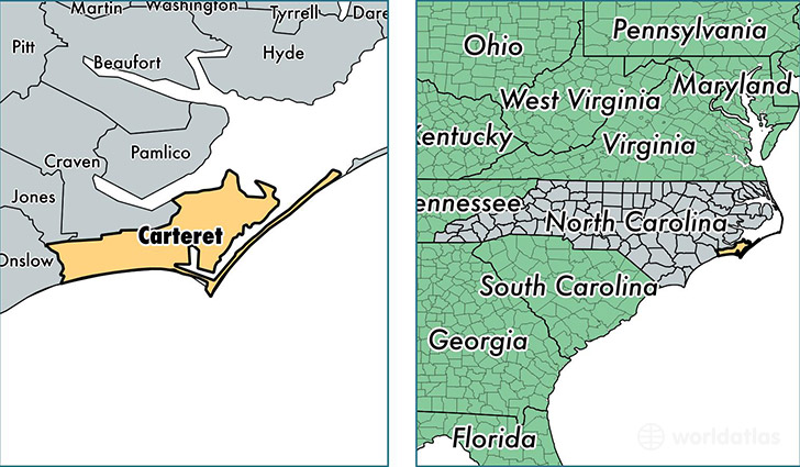
Carteret County is a county equivalent area found in North Carolina, USA. The county government of Carteret is found in the county seat of Beaufort.
With a total 3,472.12 sq. km of land and water area, Carteret County, North Carolina is the 504th largest county equivalent area in the United States. Home to 68,811 people, Carteret County has a total 48511 households earning 46534 on average per year.
Carteret County, North Carolina offers the following attraction to visitors: Cape Lookout NS
Carteret County, North Carolina - Quick Facts
| FIPS Code | 37031 |
| Area Codes | 252 |
| Time Zone | EST |
| Major Cities | Newport (population: 21,806), Morehead City (population: 14,681), Swansboro (population: 11,663), Beaufort (population: 11,631), Emerald Isle (population: 3,718), Atlantic Beach (population: 2,946), Harkers Island (population: 1,228), Atlantic (population: 706), Gloucester (population: 655), Smyrna (population: 632) |
| Land Area | 26,568 sq miles |
| Water Area | 506 sq miles |
| Household Income | $46,534 |
| Housing Units | 48,511 |
| Median Home Value | $199,200 |
| High School Grads | 88% of population |
| Holders of Bachelors Degrees | 24% of population |
| Retail Spending | $15,467 per capita |
| Food & Accomodation Sales | $151,047 per capita |
This page was last updated on June 30, 2016.