Where is Prairie County, Montana?
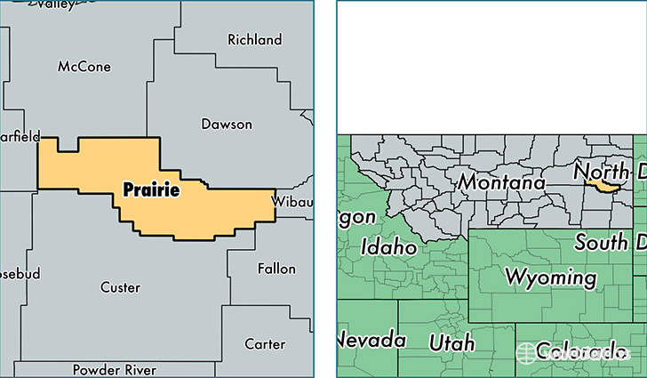
Prairie County is a county equivalent area found in Montana, USA. The county government of Prairie is found in the county seat of Terry.
With a total 4,513.15 sq. km of land and water area, Prairie County, Montana is the 386th largest county equivalent area in the United States. Home to 1,148 people, Prairie County has a total 668 households earning 38036 on average per year.
Prairie County, Montana - Quick Facts
| FIPS Code | 30079 |
| Area Codes | 406 |
| Time Zone | MST |
| Major Cities | Terry (population: 896), Fallon (population: 260) |
| Land Area | 443 sq miles |
| Water Area | 1,737 sq miles |
| Household Income | $38,036 |
| Housing Units | 668 |
| Median Home Value | $69,800 |
| High School Grads | 87% of population |
| Holders of Bachelors Degrees | 17% of population |
| Retail Spending | $7,025 per capita |
| Food & Accomodation Sales | $883 per capita |
This page was last updated on June 30, 2016.