Where is Atchison County, Missouri?
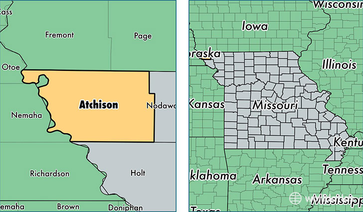
Atchison County is a county equivalent area found in Missouri, USA. The county government of Atchison is found in the county seat of Rock Port.
With a total 1,424.82 sq. km of land and water area, Atchison County, Missouri is the 2005th largest county equivalent area in the United States. Home to 5,382 people, Atchison County has a total 2959 households earning 44426 on average per year.
Atchison County, Missouri - Quick Facts
| FIPS Code | 29005 |
| Area Codes | 660 |
| Time Zone | CST |
| Major Cities | Rock Port (population: 2,038), Tarkio (population: 1,819), Fairfax (population: 1,083), Westboro (population: 363), Watson (population: 149) |
| Land Area | 2,078 sq miles |
| Water Area | 547 sq miles |
| Household Income | $44,426 |
| Housing Units | 2,959 |
| Median Home Value | $76,400 |
| High School Grads | 89% of population |
| Holders of Bachelors Degrees | 21% of population |
| Retail Spending | $14,207 per capita |
| Food & Accomodation Sales | $4,510 per capita |
This page was last updated on June 30, 2016.