Where is Andrew County, Missouri?
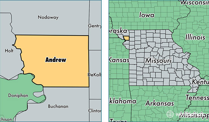
Andrew County is a county equivalent area found in Missouri, USA. The county government of Andrew is found in the county seat of Savannah.
With a total 1,130.35 sq. km of land and water area, Andrew County, Missouri is the 2407th largest county equivalent area in the United States. Home to 17,379 people, Andrew County has a total 7250 households earning 54336 on average per year.
Andrew County, Missouri - Quick Facts
| FIPS Code | 29003 |
| Area Codes | 816 |
| Time Zone | CST |
| Major Cities | Savannah (population: 8,183), Amazonia (population: 958), Cosby (population: 786), Rosendale (population: 714), Bolckow (population: 610), Helena (population: 475), Fillmore (population: 454), Rea (population: 309) |
| Land Area | 6,710 sq miles |
| Water Area | 433 sq miles |
| Household Income | $54,336 |
| Housing Units | 7,250 |
| Median Home Value | $127,700 |
| High School Grads | 90% of population |
| Holders of Bachelors Degrees | 22% of population |
| Retail Spending | $4,751 per capita |
| Food & Accomodation Sales | $4,479 per capita |
This page was last updated on June 30, 2016.