Where is Macomb County, Michigan?
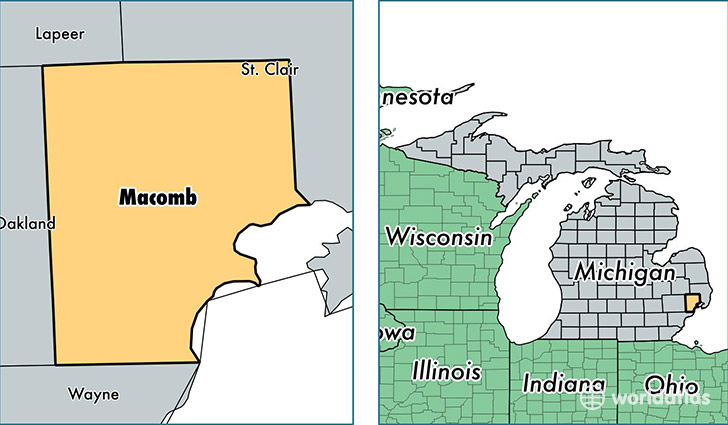
Macomb County is a county equivalent area found in Michigan, USA. The county government of Macomb is found in the county seat of Mount Clemens.
With a total 1,478.49 sq. km of land and water area, Macomb County, Michigan is the 1923rd largest county equivalent area in the United States. Home to 860,112 people, Macomb County has a total 359614 households earning 53451 on average per year.
Macomb County, Michigan - Quick Facts
| FIPS Code | 26099 |
| Area Codes | 586 |
| Time Zone | EST |
| Major Cities | Warren (population: 135,074), Sterling Heights (population: 130,669), Clinton Township (population: 97,560), Macomb (population: 80,185), Utica (population: 79,174), Saint Clair Shores (population: 60,132), New Baltimore (population: 57,165), Roseville (population: 47,748), Eastpointe (population: 32,599), Harrison Township (population: 24,791) |
| Land Area | 332,091 sq miles |
| Water Area | 479 sq miles |
| Household Income | $53,451 |
| Housing Units | 359,614 |
| Median Home Value | $123,100 |
| High School Grads | 88% of population |
| Holders of Bachelors Degrees | 23% of population |
| Retail Spending | $12,074 per capita |
| Food & Accomodation Sales | $1,120,853 per capita |
| Universities and Colleges | Virginia Farrell Beauty School |
This page was last updated on June 30, 2016.