Where is Houghton County, Michigan?
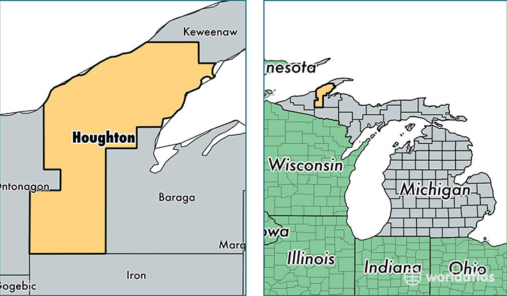
Houghton County is a county equivalent area found in Michigan, USA. The county government of Houghton is found in the county seat of Houghton.
With a total 3,888.87 sq. km of land and water area, Houghton County, Michigan is the 446th largest county equivalent area in the United States. Home to 36,495 people, Houghton County has a total 18560 households earning 35430 on average per year.
Houghton County, Michigan offers the following attraction to visitors: Keweenaw NHP
Houghton County, Michigan - Quick Facts
| FIPS Code | 26061 |
| Area Codes | 906 |
| Time Zone | EST |
| Major Cities | Houghton (population: 9,601), Calumet (population: 7,231), Hancock (population: 6,966), Chassell (population: 2,756), Lake Linden (population: 2,615), Atlantic Mine (population: 1,999), Pelkie (population: 1,257), Dollar Bay (population: 1,039), South Range (population: 1,020), Hubbell (population: 897) |
| Land Area | 14,091 sq miles |
| Water Area | 1,009 sq miles |
| Household Income | $35,430 |
| Housing Units | 18,560 |
| Median Home Value | $88,400 |
| High School Grads | 91% of population |
| Holders of Bachelors Degrees | 29% of population |
| Retail Spending | $9,599 per capita |
| Food & Accomodation Sales | $46,469 per capita |
This page was last updated on June 30, 2016.