Where is Branch County, Michigan?
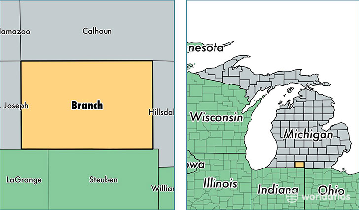
Branch County is a county equivalent area found in Michigan, USA. The county government of Branch is found in the county seat of Coldwater.
With a total 1,345.95 sq. km of land and water area, Branch County, Michigan is the 2105th largest county equivalent area in the United States. Home to 43,545 people, Branch County has a total 20568 households earning 41856 on average per year.
Branch County, Michigan - Quick Facts
| FIPS Code | 26023 |
| Area Codes | 517 |
| Time Zone | EST |
| Major Cities | Coldwater (population: 24,109), Quincy (population: 6,383), Bronson (population: 6,192), Union City (population: 3,995), Montgomery (population: 1,897), Sherwood (population: 1,817) |
| Land Area | 16,813 sq miles |
| Water Area | 507 sq miles |
| Household Income | $41,856 |
| Housing Units | 20,568 |
| Median Home Value | $98,000 |
| High School Grads | 86% of population |
| Holders of Bachelors Degrees | 13% of population |
| Retail Spending | $8,581 per capita |
| Food & Accomodation Sales | $44,710 per capita |
This page was last updated on June 30, 2016.