Where is Charles County, Maryland?
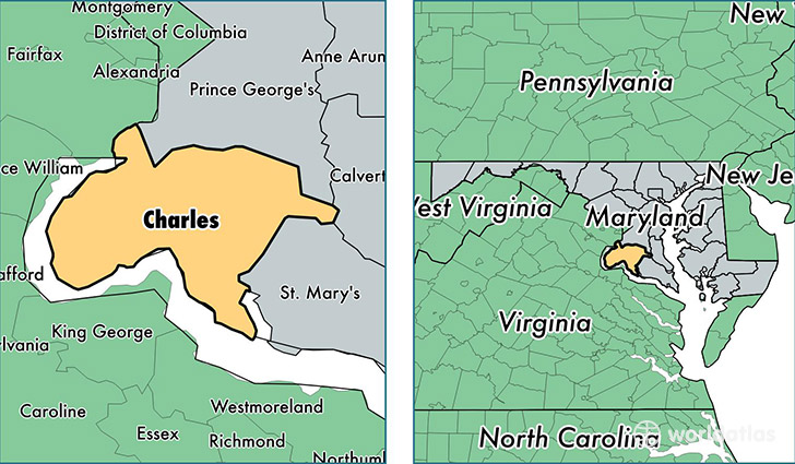
Charles County is a county equivalent area found in Maryland, USA. The county government of Charles is found in the county seat of La Plata.
With a total 1,665.17 sq. km of land and water area, Charles County, Maryland is the 1596th largest county equivalent area in the United States. Home to 154,747 people, Charles County has a total 56769 households earning 93160 on average per year.
Charles County, Maryland offers the following attractions to visitors: Piscataway Park, Thomas Stone NHS
Charles County, Maryland - Quick Facts
| FIPS Code | 24017 |
| Area Codes | 301 |
| Time Zone | EST |
| Major Cities | Waldorf (population: 80,228), La Plata (population: 19,410), Indian Head (population: 10,725), White Plains (population: 6,981), Bryans Road (population: 6,018), Hughesville (population: 5,572), Charlotte Hall (population: 5,050), Newburg (population: 3,069), Nanjemoy (population: 3,014), Port Tobacco (population: 2,386) |
| Land Area | 59,748 sq miles |
| Water Area | 458 sq miles |
| Household Income | $93,160 |
| Housing Units | 56,769 |
| Median Home Value | $297,900 |
| High School Grads | 91% of population |
| Holders of Bachelors Degrees | 27% of population |
| Retail Spending | $16,846 per capita |
| Food & Accomodation Sales | $231,630 per capita |
This page was last updated on June 30, 2016.