Where is Barnstable County, Massachusetts?
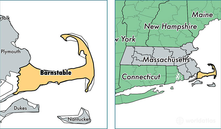
Barnstable County is a county equivalent area found in Massachusetts, USA. The county government of Barnstable is found in the county seat of Barnstable.
With a total 3,381.33 sq. km of land and water area, Barnstable County, Massachusetts is the 520th largest county equivalent area in the United States. Home to 214,914 people, Barnstable County has a total 160978 households earning 60526 on average per year.
Barnstable County, Massachusetts offers the following attraction to visitors: Cape Cod NS
Barnstable County, Massachusetts - Quick Facts
| FIPS Code | 25001 |
| Area Codes | 508 |
| Time Zone | EST |
| Major Cities | East Falmouth (population: 19,540), Hyannis (population: 14,058), Mashpee (population: 13,975), Buzzards Bay (population: 13,822), Centerville (population: 10,718), Sandwich (population: 10,336), Brewster (population: 9,658), Harwich (population: 9,642), South Yarmouth (population: 9,350), West Yarmouth (population: 8,383) |
| Land Area | 82,979 sq miles |
| Water Area | 394 sq miles |
| Household Income | $60,526 |
| Housing Units | 160,978 |
| Median Home Value | $366,700 |
| High School Grads | 95% of population |
| Holders of Bachelors Degrees | 39% of population |
| Retail Spending | $17,878 per capita |
| Food & Accomodation Sales | $890,997 per capita |
This page was last updated on June 30, 2016.