Where is Dukes County, Massachusetts?
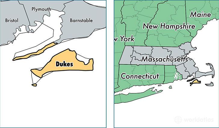
Dukes County is a county equivalent area found in Massachusetts, USA. The county government of Dukes is found in the county seat of Edgartown.
With a total 1,271.58 sq. km of land and water area, Dukes County, Massachusetts is the 2215th largest county equivalent area in the United States. Home to 17,356 people, Dukes County has a total 17399 households earning 66288 on average per year.
Dukes County, Massachusetts - Quick Facts
| FIPS Code | 25007 |
| Area Codes | 508 |
| Time Zone | EST |
| Major Cities | Oak Bluffs (population: 4,628), Edgartown (population: 4,191), Vineyard Haven (population: 4,122), West Tisbury (population: 2,808), Chilmark (population: 1,213), Cuttyhunk (population: 53) |
| Land Area | 6,701 sq miles |
| Water Area | 103 sq miles |
| Household Income | $66,288 |
| Housing Units | 17,399 |
| Median Home Value | $665,300 |
| High School Grads | 93% of population |
| Holders of Bachelors Degrees | 41% of population |
| Retail Spending | $22,333 per capita |
| Food & Accomodation Sales | $95,785 per capita |
This page was last updated on June 30, 2016.