Where is Rapides Parish, Louisiana?
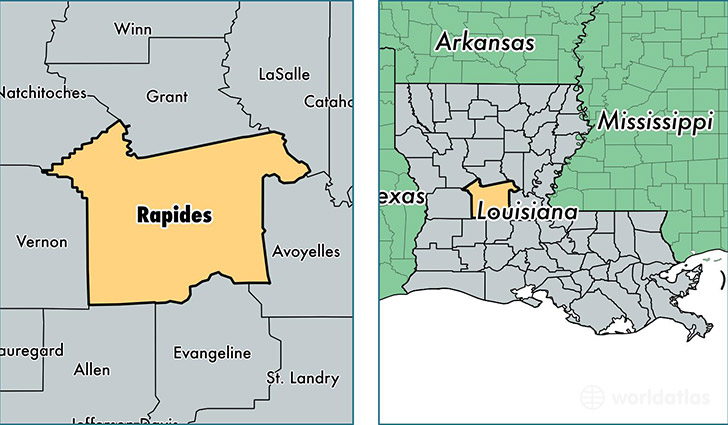
Rapides Parish is a county equivalent area found in Louisiana, USA. The parish government of Rapides is found in the parish seat of Alexandria.
With a total 3,526.68 sq. km of land and water area, Rapides Parish, Louisiana is the 498th largest county equivalent area in the United States. Home to 132,488 people, Rapides Parish has a total 56553 households earning 40930 on average per year.
Rapides Parish, Louisiana - Quick Facts
| FIPS Code | 22079 |
| Area Codes | 318 |
| Time Zone | CST |
| Major Cities | Alexandria (population: 59,261), Pineville (population: 35,550), Deville (population: 7,449), Boyce (population: 6,913), Ball (population: 5,624), Glenmora (population: 4,392), Lecompte (population: 3,057), Forest Hill (population: 2,590), Woodworth (population: 1,814), Hineston (population: 1,647) |
| Land Area | 51,154 sq miles |
| Water Area | 1,318 sq miles |
| Household Income | $40,930 |
| Housing Units | 56,553 |
| Median Home Value | $120,400 |
| High School Grads | 82% of population |
| Holders of Bachelors Degrees | 18% of population |
| Retail Spending | $14,369 per capita |
| Universities and Colleges | Alexandria Academy of Beauty Culture, Louisiana Technical College-Alexandria Campus |
This page was last updated on June 30, 2016.