Where is Benton County, Indiana?
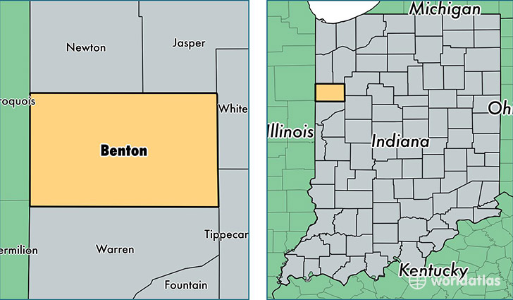
Benton County is a county equivalent area found in Indiana, USA. The county government of Benton is found in the county seat of Fowler.
With a total 1,052.85 sq. km of land and water area, Benton County, Indiana is the 2568th largest county equivalent area in the United States. Home to 8,700 people, Benton County has a total 3916 households earning 48711 on average per year.
Benton County, Indiana - Quick Facts
| FIPS Code | 18007 |
| Area Codes | 765,219 |
| Time Zone | EST |
| Major Cities | Fowler (population: 3,602), Otterbein (population: 2,027), Oxford (population: 1,854), Boswell (population: 1,070), Earl Park (population: 656), Ambia (population: 485), Templeton (population: 62) |
| Land Area | 3,359 sq miles |
| Water Area | 407 sq miles |
| Household Income | $48,711 |
| Housing Units | 3,916 |
| Median Home Value | $84,300 |
| High School Grads | 89% of population |
| Holders of Bachelors Degrees | 16% of population |
| Retail Spending | $5,852 per capita |
| Food & Accomodation Sales | $2,561 per capita |
This page was last updated on June 30, 2016.