Where is Mahaska County, Iowa?
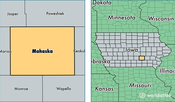
Mahaska County is a county equivalent area found in Iowa, USA. The county government of Mahaska is found in the county seat of Oskaloosa.
With a total 1,485.09 sq. km of land and water area, Mahaska County, Iowa is the 1897th largest county equivalent area in the United States. Home to 22,370 people, Mahaska County has a total 9713 households earning 47967 on average per year.
Mahaska County, Iowa - Quick Facts
| FIPS Code | 19123 |
| Area Codes | 641 |
| Time Zone | CST |
| Major Cities | Oskaloosa (population: 15,096), New Sharon (population: 2,543), Fremont (population: 964), Leighton (population: 601), Rose Hill (population: 522), University Park (population: 417), Cedar (population: 291), Barnes City (population: 285), Beacon (population: 284) |
| Land Area | 8,637 sq miles |
| Water Area | 571 sq miles |
| Household Income | $47,967 |
| Housing Units | 9,713 |
| Median Home Value | $100,900 |
| High School Grads | 91% of population |
| Holders of Bachelors Degrees | 22% of population |
| Retail Spending | $10,995 per capita |
| Food & Accomodation Sales | $16,819 per capita |
| Universities and Colleges | Vennard College |
This page was last updated on June 30, 2016.