Where is Lee County, Iowa?
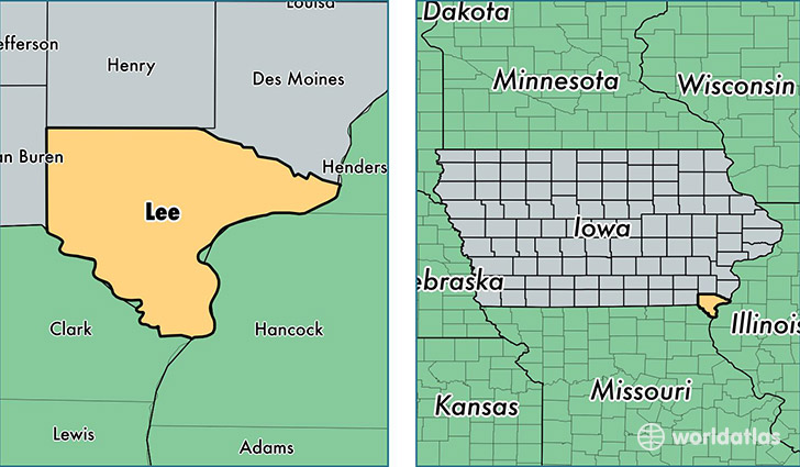
Lee County is a county equivalent area found in Iowa, USA. The county government of Lee is found in the county seat of Keokuk.
With a total 1,395.67 sq. km of land and water area, Lee County, Iowa is the 2043rd largest county equivalent area in the United States. Home to 35,286 people, Lee County has a total 16161 households earning 42469 on average per year.
Lee County, Iowa - Quick Facts
| FIPS Code | 19111 |
| Area Codes | 319 |
| Time Zone | CST |
| Major Cities | Fort Madison (population: 13,015), Keokuk (population: 12,996), Donnellson (population: 2,782), West Point (population: 2,343), Montrose (population: 1,988), Wever (population: 1,064), Argyle (population: 589), Denmark (population: 288), Saint Paul (population: 94), Houghton (population: 89) |
| Land Area | 13,624 sq miles |
| Water Area | 517 sq miles |
| Household Income | $42,469 |
| Housing Units | 16,161 |
| Median Home Value | $83,100 |
| High School Grads | 90% of population |
| Holders of Bachelors Degrees | 16% of population |
| Retail Spending | $11,745 per capita |
| Food & Accomodation Sales | $36,970 per capita |
This page was last updated on June 30, 2016.