Where is Jones County, Iowa?
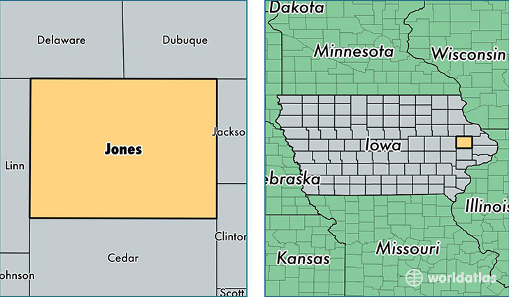
Jones County is a county equivalent area found in Iowa, USA. The county government of Jones is found in the county seat of Anamosa.
With a total 1,494.43 sq. km of land and water area, Jones County, Iowa is the 1854th largest county equivalent area in the United States. Home to 20,454 people, Jones County has a total 8881 households earning 55041 on average per year.
Jones County, Iowa - Quick Facts
| FIPS Code | 19105 |
| Area Codes | 319,563 |
| Time Zone | CST |
| Major Cities | Anamosa (population: 8,685), Monticello (population: 6,432), Olin (population: 1,202), Wyoming (population: 1,041), Oxford Junction (population: 866), Martelle (population: 630), Onslow (population: 404), Center Junction (population: 285), Morley (population: 115) |
| Land Area | 7,897 sq miles |
| Water Area | 576 sq miles |
| Household Income | $55,041 |
| Housing Units | 8,881 |
| Median Home Value | $122,100 |
| High School Grads | 91% of population |
| Holders of Bachelors Degrees | 17% of population |
| Retail Spending | $12,629 per capita |
| Food & Accomodation Sales | $9,765 per capita |
This page was last updated on June 30, 2016.