Where is Linn County, Iowa?
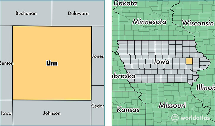
Linn County is a county equivalent area found in Iowa, USA. The county government of Linn is found in the county seat of Cedar Rapids.
With a total 1,876.46 sq. km of land and water area, Linn County, Iowa is the 1342nd largest county equivalent area in the United States. Home to 217,751 people, Linn County has a total 93722 households earning 57260 on average per year.
Linn County, Iowa - Quick Facts
| FIPS Code | 19113 |
| Area Codes | 319 |
| Time Zone | CST |
| Major Cities | Cedar Rapids (population: 136,735), Marion (population: 37,692), Hiawatha (population: 7,115), Mount Vernon (population: 5,977), Center Point (population: 4,409), Lisbon (population: 3,239), Central City (population: 3,149), Robins (population: 2,880), Fairfax (population: 2,824), Ely (population: 2,508) |
| Land Area | 84,074 sq miles |
| Water Area | 717 sq miles |
| Household Income | $57,260 |
| Housing Units | 93,722 |
| Median Home Value | $144,300 |
| High School Grads | 94% of population |
| Holders of Bachelors Degrees | 31% of population |
| Retail Spending | $17,502 per capita |
| Food & Accomodation Sales | $353,610 per capita |
| Universities and Colleges | Cornell College |
This page was last updated on June 30, 2016.