Where is Clarke County, Iowa?
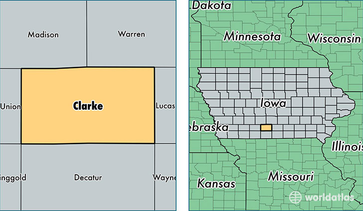
Clarke County is a county equivalent area found in Iowa, USA. The county government of Clarke is found in the county seat of Osceola.
With a total 1,118.24 sq. km of land and water area, Clarke County, Iowa is the 2436th largest county equivalent area in the United States. Home to 9,217 people, Clarke County has a total 4111 households earning 43216 on average per year.
Clarke County, Iowa - Quick Facts
| FIPS Code | 19039 |
| Area Codes | 641 |
| Time Zone | CST |
| Major Cities | Osceola (population: 6,873), Murray (population: 1,441), Woodburn (population: 536) |
| Land Area | 3,559 sq miles |
| Water Area | 431 sq miles |
| Household Income | $43,216 |
| Housing Units | 4,111 |
| Median Home Value | $84,900 |
| High School Grads | 87% of population |
| Holders of Bachelors Degrees | 14% of population |
| Retail Spending | $10,579 per capita |
| Food & Accomodation Sales | $84,923 per capita |
This page was last updated on June 30, 2016.