Where is Toombs County, Georgia?
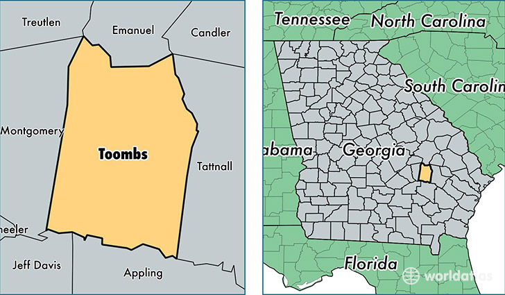
Toombs County is a county equivalent area found in Georgia, USA. The county government of Toombs is found in the county seat of Lyons.
With a total 960.86 sq. km of land and water area, Toombs County, Georgia is the 2686th largest county equivalent area in the United States. Home to 27,282 people, Toombs County has a total 12031 households earning 31189 on average per year.
Toombs County, Georgia - Quick Facts
| FIPS Code | 13279 |
| Area Codes | 912 |
| Time Zone | EST |
| Major Cities | Vidalia (population: 16,658), Lyons (population: 12,008), Uvalda (population: 2,939) |
| Land Area | 10,534 sq miles |
| Water Area | 364 sq miles |
| Household Income | $31,189 |
| Housing Units | 12,031 |
| Median Home Value | $88,100 |
| High School Grads | 79% of population |
| Holders of Bachelors Degrees | 15% of population |
| Retail Spending | $13,914 per capita |
| Food & Accomodation Sales | $42,329 per capita |
This page was last updated on June 30, 2016.