Where is Jeff Davis County, Georgia?
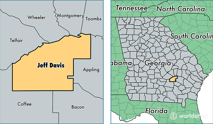
Jeff Davis County is a county equivalent area found in Georgia, USA. The county government of Jeff Davis is found in the county seat of Hazlehurst.
With a total 868.68 sq. km of land and water area, Jeff Davis County, Georgia is the 2774th largest county equivalent area in the United States. Home to 14,859 people, Jeff Davis County has a total 6374 households earning 36296 on average per year.
Jeff Davis County, Georgia - Quick Facts
| FIPS Code | 13161 |
| Area Codes | 912 |
| Time Zone | EST |
| Major Cities | Hazlehurst (population: 14,552), West Green (population: 797), Denton (population: 731) |
| Land Area | 5,737 sq miles |
| Water Area | 331 sq miles |
| Household Income | $36,296 |
| Housing Units | 6,374 |
| Median Home Value | $79,900 |
| High School Grads | 80% of population |
| Holders of Bachelors Degrees | 10% of population |
| Retail Spending | $15,440 per capita |
| Food & Accomodation Sales | $9,883 per capita |
This page was last updated on June 30, 2016.